
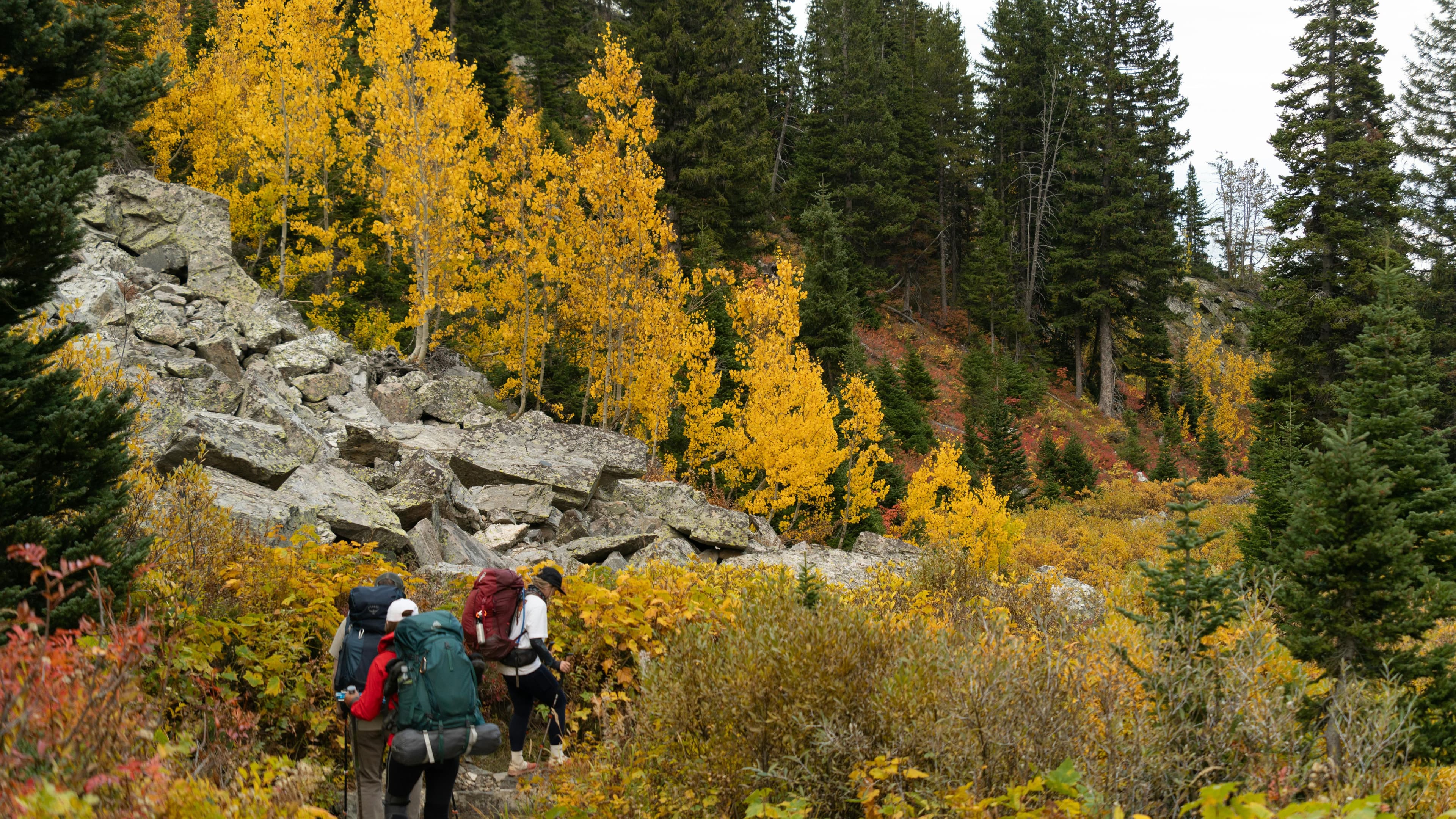
Grand Teton hiking is not like most national park hiking. The Teton Range rises almost directly from the valley floor, no foothills, no gradual approach, which means trails gain elevation fast and the views come early. Whether you are planning a single day hike or a multi-day backcountry loop, the logistics here are specific enough that generic research tends to leave real gaps.
This guide covers the best trails across skill levels, how the permit system works, when to go, and what the planning process actually looks like from start to finish.
What Makes Grand Teton Different From Other Parks
Most national parks ease you in. Grand Teton does not. The Teton fault has pushed the range nearly 30,000 feet relative to the valley over millions of years, and that geology shapes every hike. Trails that look moderate on a map often include sustained steep sections on loose rock or scree. Afternoon thunderstorms are frequent and fast-moving from July through August. Wildlife, grizzly bears, black bears, moose, bison, is genuinely present on most trails.
None of this is a reason to stay away. It is a reason to plan with more precision than you might apply elsewhere.
The park sits in northwestern Wyoming, adjacent to Yellowstone. Jackson Hole valley runs along its eastern edge, and the town of Jackson is the main gateway. Most trailheads are accessed from Teton Park Road or the Jenny Lake area. Cell service is limited inside the park, and fuel and resupply options are thin once you leave Jackson or Moose. To see how Grand Teton compares with other parks on trail variety, difficulty, and access, read the best national parks for hiking guide.
Grand Teton Hiking Trails by Difficulty
Easy to Moderate Day Hikes
Taggart Lake Loop is the most approachable introduction to the park. The loop is roughly 3.8 miles with about 400 feet of elevation gain, starting from the Taggart Lake Trailhead off Teton Park Road. The lake sits in a glacially carved basin with direct views of the central Teton peaks. Well-maintained and suitable for most fitness levels.
Jenny Lake Loop circles one of the most photographed lakes in Wyoming. The full loop is about 7.5 miles, but most hikers take the ferry across to cut the distance and access the Cascade Canyon trailhead directly. The ferry runs seasonally and reduces the round trip to around 2 miles for the canyon section alone.
Hidden Falls and Inspiration Point are typically done together as an extension from the Jenny Lake ferry landing. Hidden Falls is a short walk from the dock. Inspiration Point adds another 0.5 miles and roughly 400 feet of gain for a view over Jenny Lake and the valley. This is one of the most-visited short hikes in the park; expect company, especially mid-morning on summer weekends.
Intermediate Trails
Cascade Canyon Trail continues past Inspiration Point into one of the most dramatic canyon corridors in the range. The trail runs roughly 9 miles to the canyon fork, where you can continue toward either Lake Solitude or Hurricane Pass. The lower canyon section is popular and well-traveled. Moose sightings in the willows along the creek are common.
Amphitheater Lake earns its reputation. The trail climbs about 2,900 feet over roughly 9.5 miles round trip from the Lupine Meadows Trailhead. The lake sits at over 9,600 feet in a cirque directly below the Grand Teton summit. One of the best single-day views in the park, but the sustained elevation gain makes it a genuine physical commitment.
Phelps Lake Loop via Death Canyon Trailhead is a quieter option on the park's southern end. The loop is about 7 miles with moderate elevation change. Death Canyon itself can be accessed as an extension for those wanting more miles and gain.
Strenuous and Backcountry Trails
Lake Solitude via Cascade Canyon is a full-day objective for strong hikers. The round trip from the ferry landing is about 14.5 miles with roughly 2,200 feet of elevation gain. The lake sits above treeline at 9,035 feet, and the upper section of trail can hold snow well into July.
Paintbrush Canyon to Cascade Canyon Loop is the signature multi-day route in the park. The full circuit is around 19 miles and crosses Paintbrush Divide at nearly 10,700 feet. Most hikers complete it over 2 to 3 days with a backcountry campsite at Holly Lake or near the canyon junction. This is the route where permit logistics matter most.
Teton Crest Trail is the longer, more demanding version. The full route runs roughly 40 to 50 miles depending on the variation, crossing multiple high passes and entering Jedediah Smith Wilderness in Idaho. Sections pass through both Grand Teton National Park and adjacent national forests, which affects permit requirements.
Permits for Grand Teton Backcountry Hiking
Day hiking in Grand Teton requires no permit. You can show up, park, and walk. The permit system applies to overnight backcountry camping.
How Backcountry Permits Work
Grand Teton uses a permit system managed through Recreation.gov. Permits are required for all overnight stays at designated backcountry campsites. The park divides backcountry into zones and specific campsite designations. Some sites are individual with a single group capacity; others are open camping zones where you choose your spot within the zone boundaries.
Advance reservations open in early January for the coming season (January 7 in 2026). A portion of permits are held back for walk-up availability, which you can claim in person at the Craig Thomas Discovery and Visitor Center in Moose or the Jenny Lake Ranger Station starting the day before your planned trip.
The advance reservation system is competitive for popular routes, especially the Paintbrush-Cascade loop and sites near Lake Solitude. If you want a specific route in July or August, apply as soon as reservations open in early January. Walk-up permits for those same routes in peak season are possible but require flexibility and an early arrival at the permit desk.
Permit Fees and Group Limits
As of 2026, backcountry permits carry a per-person, per-night fee in addition to the park entrance fee. Group size limits vary by zone, with most sites capping at 6 to 12 people depending on designation. Check the park's current permit page on Recreation.gov for exact fees and availability before your trip, as these details are updated seasonally.
Campfire Rules and Bear Canister Requirements
Campfires are prohibited in most Grand Teton backcountry zones. A few lower-elevation sites near lakes permit fires in established rings when fire danger is low, but the default assumption should be no fires. A camp stove is not optional.
Approved bear canisters are required for overnight backcountry trips except where food storage boxes are provided. Hard-sided canisters are the standard. Bear boxes exist at some designated sites, but you cannot rely on them being present at your specific campsite.
For a detailed breakdown of multi-day backcountry logistics: campsite selection, resupply planning, and what to carry, the guide on planning a multi-day backcountry trip with campsites and resupply covers the process in depth.
When to Go: Seasonal Conditions
June
Snow lingers on high passes well into June. Lower trails like Taggart Lake and the Jenny Lake Loop are typically clear by early June. High routes including Paintbrush Divide and the Teton Crest Trail often hold significant snow through mid-June and require route-finding experience and appropriate footwear. River crossings can be dangerous during peak snowmelt.
July and August
Peak season. All major trails are accessible, wildflowers are at their best in July, and the backcountry is fully operational. Afternoon thunderstorms are common and can develop quickly above treeline. Start high-elevation hikes early, plan to be below exposed ridges by early afternoon, and carry rain gear regardless of the morning forecast.
This is also when the park is most crowded. Trailhead parking at Jenny Lake and Lupine Meadows fills before 8 a.m. on summer weekends. Arriving early is not optional if you want a spot.
September
The best month for many experienced hikers. Crowds drop sharply after Labor Day. Temperatures are cooler, afternoon storms become less frequent, and fall color in the aspens and willows starts in mid-September. High passes can receive early snow by late September, so check conditions before committing to routes above 10,000 feet.
October and Beyond
Most facilities close after Columbus Day weekend. The park remains open, but services are minimal. Winter hiking and snowshoeing are possible, but conditions are serious and require appropriate gear and experience.
Getting to Trailheads and Parking
Jackson Hole Airport (JAC) is the closest commercial airport, located inside the park boundary. Driving from Salt Lake City takes roughly 5 hours; from Denver, closer to 8 hours. The town of Jackson is the main base for most visitors.
Inside the park, Teton Park Road runs between Moose and Jackson Lake Junction and provides access to most major trailheads. The Jenny Lake Scenic Drive, a short side loop off it, is one-way.
Parking at Jenny Lake is the most constrained in the park. The lot fills early. There is no park-run shuttle to the trailhead, so an early arrival is the reliable plan. Lupine Meadows Trailhead, which serves Amphitheater Lake and Garnet Canyon, also fills quickly on summer mornings.
If you are driving from outside the region and building a broader Wyoming or Greater Yellowstone trip around this visit, the driving legs, fuel stops, and trailhead logistics can add up fast. Xavier, the AI agent companion at Xploreum, can organize the full Xpedition around your specific starting point, vehicle, dates, and group, pulling together driving legs, trailheads, campsites, and accommodations into one connected plan rather than a collection of browser tabs. For a four-day plan next door, see Yellowstone in four days: one base or two.
Wildlife and Safety on the Trail
Grand Teton has one of the highest concentrations of grizzly bears in the lower 48. Black bears are also present. Carry bear spray, know how to use it, and keep it accessible, not buried in your pack. Hiking in groups of 3 or more significantly reduces bear encounter risk.
Moose are common near willows and wetlands, especially in Cascade Canyon and along the Snake River corridor. They are large, unpredictable, and more likely to charge than retreat. Give them space.
Bison are present in the valley and occasionally on trails near the eastern edge of the park. Same approach: distance and patience.
Lightning is the other serious hazard. The Tetons act as a trigger for afternoon convection, and storms can develop faster than the forecast suggests. Watch the sky, not just your weather app.
Hiking with Dogs in Grand Teton
The rules here are strict. Dogs are permitted only where a car can go: roads and road shoulders, parking areas, campgrounds, and picnic areas, within 30 feet of the roadway. They are not permitted on any trails, in the backcountry, or on the Jenny Lake ferry. This is a firm park regulation, not a suggestion.
If you are planning a broader trip that includes dog-friendly hiking before or after your Grand Teton visit, the guide to dog-friendly hiking trails across North America covers options by region and difficulty.
Planning Tools for a Grand Teton Hiking Trip
The research load for a Grand Teton trip is higher than most parks. The permit system, trailhead logistics, weather variability, and the range of trail options across skill levels mean most people end up with a trail app open, a permit window running, an accommodation search going, and a map trying to figure out how the driving legs connect.
For trail navigation, apps like AllTrails and Gaia GPS are the right tools. They carry the trail data, offline maps, and community conditions that matter for route-finding. Xploreum does not replace those tools.
Where Xavier adds value is in organizing the Xpedition around the trails you have already identified: the drive from your starting point, where you stay the night before an early trailhead start, which campsites fit your permit dates, how the days sequence given your group's pace and skill level, and what fuel and meal stops exist along the route. That coordination layer is where most of the planning time actually goes, and a structured Xpedition handles it more cleanly than a text itinerary.
For a broader look at how different apps handle the planning side of hiking trips, the guide to best apps for hiking, camping, and trip planning covers the current options honestly, including where each one stops.
If you are specifically evaluating AI tools for backcountry trip planning, the comparison of best AI trip planning apps for backcountry hiking covers the differences in how these tools handle outdoor-specific logistics.
Building Your Grand Teton Hiking Itinerary
A practical approach for most visitors:
- Decide your primary objective. One big hike anchors the trip. Amphitheater Lake, Lake Solitude, and the Paintbrush-Cascade loop are the most common anchors for serious hikers.
- Check permit availability before booking anything else. If your primary objective requires a backcountry permit, confirm availability on Recreation.gov before committing to dates.
- Build the driving legs around the trailhead. Most trailheads require an early start. Plan your accommodation so you are within 20 to 30 minutes of the trailhead the night before.
- Add secondary hikes for other days. Taggart Lake, Hidden Falls, and the Jenny Lake Loop are strong secondary options that require no permits and no early parking scramble.
- Plan for weather flexibility. Build a buffer day or an alternate lower-elevation hike in case afternoon storms or poor conditions push your primary objective.
- Confirm fuel and resupply before you leave Jackson. Options inside the park are limited. Jackson is your last reliable stop.
Turn what you read into a trip.
Bring the route, campsites, and stops together with Xavier.
FAQs
Do you need a permit for day hiking in Grand Teton?
No. Day hiking on all trails in Grand Teton National Park requires no permit. Permits are only required for overnight backcountry camping at designated sites or within designated zones.
When do Grand Teton backcountry permits go on sale?
Advance reservations open in early January each year (January 7 in 2026) through Recreation.gov for the upcoming season. A portion of permits are available as walk-up permits starting the day before your intended trip from the Craig Thomas Visitor Center in Moose or the Jenny Lake Ranger Station.
What is the hardest day hike in Grand Teton?
Amphitheater Lake is widely considered the most demanding standard day hike, with roughly 2,900 feet of elevation gain over about 9.5 miles round trip. Garnet Canyon, which approaches the base of the Grand Teton summit, is longer and more technical and is typically attempted by those with scrambling experience.
Are bear canisters required in Grand Teton?
Yes. Approved bear canisters are required for overnight backcountry trips in Grand Teton National Park except where food storage boxes are provided, so check whether your specific site has one.
Can you bring dogs on trails in Grand Teton?
No. Dogs are not permitted on any trails in Grand Teton National Park. They are allowed only where a car can go: roads and road shoulders, parking areas, campgrounds, and picnic areas. This applies to all leashed dogs regardless of size or behavior.
What time should you arrive at Jenny Lake Trailhead in summer?
The Jenny Lake parking lot typically fills before 8 a.m. on summer weekends and often earlier in July. Arriving before 7 a.m. is the safest approach. There is no park-run shuttle to the trailhead, so an early arrival is the reliable plan.
How long does it take to hike to Lake Solitude from Jenny Lake?
The round trip from the Jenny Lake ferry landing to Lake Solitude is approximately 14.5 miles with around 2,200 feet of elevation gain. Most fit hikers complete it in 7 to 9 hours. Taking the ferry in both directions saves roughly 2 miles and is strongly recommended for this objective.
Grand Teton hiking is specific enough that vague research leaves real gaps. The trails are exceptional, the permit system is manageable if you engage it early, and the logistics come together cleanly once you have the pieces in the right order. Start with your primary objective, secure the permit before you book anything else, and build the rest of the Xpedition around it.
Sources
- National Park Service: Backcountry camping permits, Grand Teton National Park. Accessed October 5, 2026.
- National Park Service: How do I use a bear canister?, Grand Teton National Park. Accessed October 5, 2026.
- National Park Service: Pets, Grand Teton National Park. Accessed October 5, 2026.
- National Park Service: Jenny Lake, Grand Teton National Park. Accessed October 5, 2026.
- National Park Service: Jenny Lake Scenic Drive. Accessed October 5, 2026.
- National Park Service: Safety in bear country, Grand Teton National Park. Accessed October 5, 2026.