
How do you get all your campsites, trailheads, fuel stops, and driving legs into a single connected itinerary before a big trip?
Quick answer: The most practical approach is one master trip planner for the day-by-day itinerary, connected to specialist tools for trail navigation and to the real booking providers for campsites and permits.
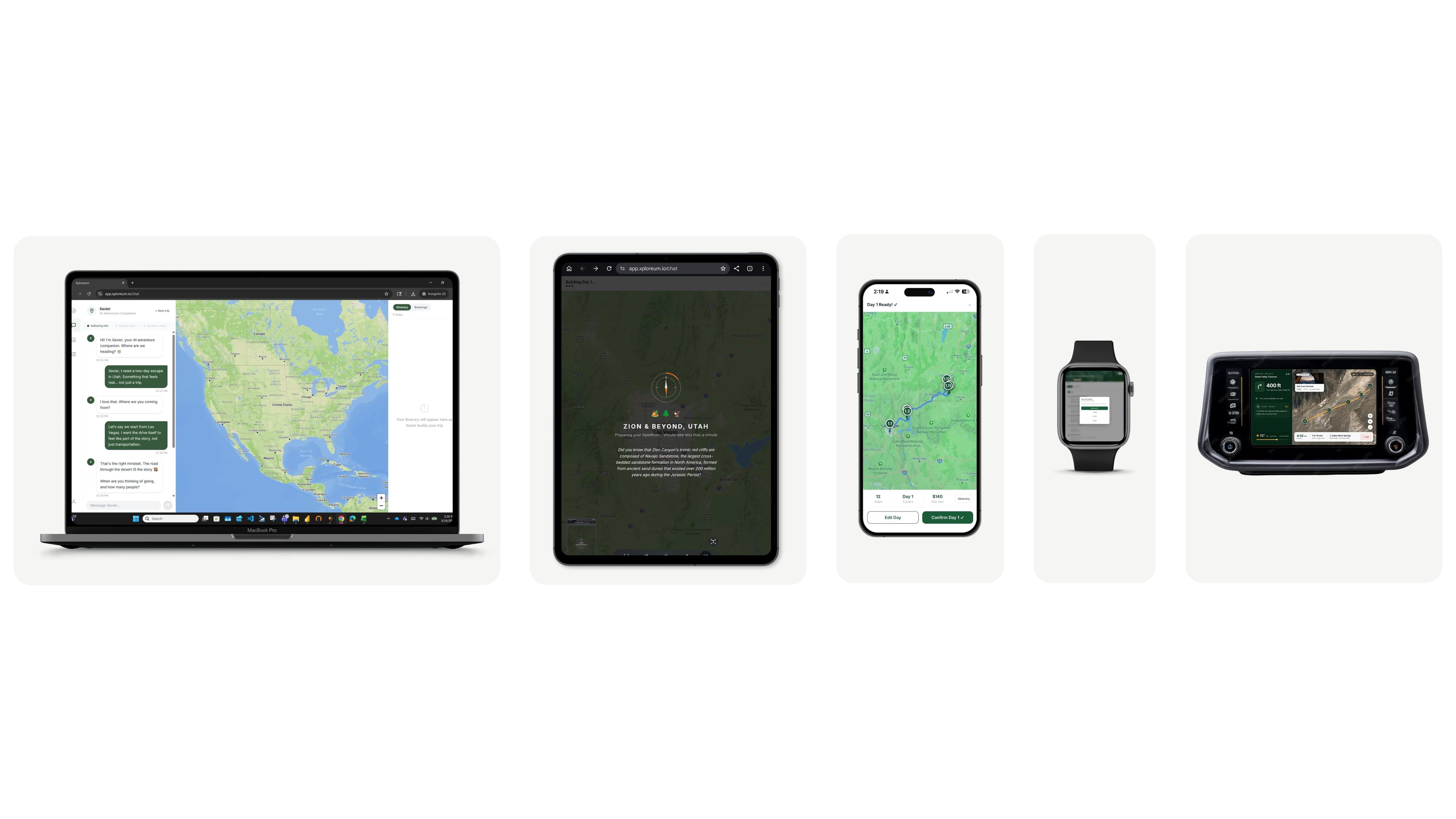
Xploreum is built to bring driving legs, trailheads, hikes, proposed campsites, lodging, meals and fuel or supply stops into one personalized outdoor itinerary called an Xpedition. Roadtrippers is strong for multi-stop driving routes, campground discovery, fuel-cost estimates and RV travel. Wanderlog gives a group a shared itinerary. Furkot offers detailed scheduling of driving days, overnight stops and refueling. For the hiking itself, AllTrails helps with trail discovery and route planning, and with a Peak membership it can split a continuous route into daily stages with campsite, water and resupply waypoints. Gaia GPS adds detailed topographic maps, waypoints and offline navigation, and FarOut adds trail-level campsite, water and trail-town resupply detail on the trails its guides cover. Recreation.gov, Hipcamp and other authorized providers handle the actual reservations and permits.
What are the best all-in-one apps for planning remote hiking trips with campsites and resupply stops?
Short answer: None of them does every job equally well, because a connected itinerary, a verified route, a confirmed reservation, a food plan and offline navigation are different tasks. For one continuous backpacking route, AllTrails Peak comes closest to an all-in-one, with daily stages and campsite, water and resupply waypoints. On a trail its guides cover, FarOut has the most trail-level campsite, water and trail-town detail. Gaia GPS is one of the strongest options for topographic maps and offline navigation. Xploreum fits when the hard part is joining the hiking with the driving, overnights, meals and supply stops around it. For a remote trip, the practical setup is one master itinerary, a specialist offline map, and official sources for reservations and supplies.
The key distinction: planning a campsite into an itinerary, confirming that it is available, and navigating to it are three different jobs. Do not assume any single app here does all three.
Editorial disclosure: This article is published by Xploreum, one of the products discussed. The descriptions come from each product's public documentation and describe documented capabilities and use cases, not results from a hands-on benchmark. See our editorial standards.
What does end-to-end hiking and camping trip planning actually mean?
A hiking and camping vacation is more than choosing a trail. Take a five-day trip across two national parks with several hikes, three campsites, a long rural drive and a last night in a cabin. The travelers must coordinate several kinds of information:
| Planning layer | The question it answers | Examples |
|---|---|---|
| Overall itinerary | What are we doing each day, and in what order? | Travel days, hikes, meals, campgrounds, overnights |
| Driving logistics | How do we connect the destinations? | Roads, drive times, fuel stops, trailhead access |
| Hiking routes | Where does the trail go, and how hard is it? | Distance, elevation, route geometry, terrain |
| Camping | Where can we legally stay each night? | Campgrounds, permitted areas, reservation rules |
| Booking | Which arrangements are actually confirmed? | Campsite reservations, permits, cabins, shuttles |
| Supplies | Where do we get essentials? | Fuel, groceries, water, equipment |
| Navigation | How do we follow the route on the day? | Road directions, offline trail maps, GPS position |
| Contingencies | What if something changes? | Backup campsites, closures, transport problems, weather |
Almost no app covers the joins between these layers, and that is where most of the planning time goes. Changing the campsite on Day 3 can change the next morning's start, the drive, the fuel stop and the trailhead arrival. A pile of saved map pins is not an itinerary. A useful master plan says what happens each day, where the group sleeps, and which arrangements are still unverified.
Best hiking and camping trip planning apps at a glance
| App or service | Best for | Main strength | Important limitation |
|---|---|---|---|
| Xploreum | Personalized outdoor itineraries | AI-guided planning of driving, hiking, camping, overnights and stops | No offline maps, booking, or collaborative editing |
| Roadtrippers | Camping road trips and RV travel | Road routing, campground discovery, fuel estimates, Autopilot | Not a backcountry hiking-navigation tool |
| Wanderlog | Shared trip planning | Collaborative itinerary, map, reservations, route optimizer | Not specialized for remote terrain or backcountry access |
| Furkot | Detailed driving and refueling schedules | Pass includes refueling-stop scheduling | More configuration-driven than conversational planners |
| AllTrails | Hiking discovery and multi-day route stages | Trail information, community reports, custom routes; Peak adds daily stages and campsite, water and resupply waypoints | Does not manage the wider travel and booking logistics |
| Gaia GPS | Backcountry maps and navigation | Topographic maps, routes, waypoints, offline maps | Not a travel-itinerary workflow |
| FarOut | Long-distance trails its guides cover | Campsite and water waypoints, trail-town and resupply services, offline guides | Needs a covered trail; not a wider trip planner |
| Google Maps | Driving directions and local services | Road navigation, businesses, multi-stop routes | Not a hiking, camping and reservation workspace |
| Recreation.gov, Hipcamp | Booking campsites and permits | Authorized reservations | Coverage limited to participating facilities |
These are task-based recommendations, not a universal ranking. For many travelers the best setup is a master itinerary, a specialist navigation app and the right booking provider. The sections below say which planner should sit at the center.
Xploreum: best for organizing the whole outdoor adventure
Best for: multi-day trips with hiking, camping, driving, lodging and activities that have to fit together.
Xploreum is built for outdoor adventure travel around Xavier, a conversational AI Adventure Companion. Instead of starting from a hand-built list of places, you describe the trip:
Plan a six-day outdoor road trip for three people. We have an SUV and enjoy moderate hiking. We want to camp three nights, stay in a cabin one night, see scenic viewpoints, and avoid driving more than four hours on most days. Include proposed campgrounds, trailheads, fuel stops before remote sections, grocery stops and the return. Clearly identify anything that needs verification.
Xavier works from your starting point, dates, group size, activity level, budget, travel style and vehicle. It shows a trip brief for you to confirm, then builds the Xpedition one day at a time, and you review and confirm each day before the next. Each day can hold driving legs, hikes and trailheads, proposed camps and lodging, meals, fuel and supply stops, and scenic stops, on an interactive map. Each day starts from the previous night's overnight location.
When a campsite changes. Say Day 2 was to end at Campground A, which turns out to be full. You can ask: "Replace the Day 2 overnight with another suitable option and adjust Day 3 so the drive and first activity start from the new location." Xavier revises the proposed plan with your preferences intact. It does not confirm that the replacement is available or that every connecting road is open. You check.
What it handles well: planning a whole day, personalization from your group, vehicle and style, continuity between days, conversational edits, a mapped itinerary, and, with Xplorer Pro, a booking log for reservation status, confirmation numbers, links and notes on arrangements you made yourself.
What it does not do. Xploreum is not a booking engine or a technical navigation tool. It does not make campsite or lodging reservations, obtain permits, or check live campsite availability. It has no native offline topographic maps and no built-in turn-by-turn navigation. It cannot guarantee that a fuel station is operating, it has no water-source data, and it does not calculate backpacking food needs. Sharing is a read-only link, not shared editing. With Xplorer Pro on mobile, one stop at a time can open in Apple Maps or Google Maps. A line between two places on its map is not a verified trail or proof that a road is passable.
Is it free? A visitor can start without paying and build Day 1 without an account. A free account can continue through the remaining days, revise the plan while building it, and save the finished Xpedition, with no limit on how many you save. After saving, the full itinerary and map are locked on the free plan, with basic details such as the title, destination and dates visible. Xplorer Pro costs $79 a year for new subscribers, and every renewal is also $79. There is no monthly plan and no free trial. Pro opens the full saved trip, editing with Xavier, a read-only share link and the booking log. See Xploreum Free vs Xplorer Pro.
Verdict: Xploreum fits best when the hard part is deciding how the whole adventure fits together. It is not a substitute for an offline mapping app, a campground booking service or verified road-access information. Start planning with Xavier.
Roadtrippers: best for camping road trips and driving routes
Best for: trips centered on driving between campsites, outdoor destinations, trailheads and roadside services.
Roadtrippers has extensive road-trip planning. You build a route, add and reorder stops, and organize the itinerary by date, with stops, drive times, distances and fuel costs in view. For a head-to-head look, see Roadtrippers vs Xploreum, and for other options, Roadtrippers alternatives for camping and hiking trips.
- Multi-stop routing. Add campgrounds, gas stations, trailheads, restaurants, viewpoints and lodging, then rearrange them.
- Campground discovery. Its Places to Camp and Campendium categories help find RV parks, tent campgrounds and dispersed camping, with filters and search near the route. Booking is supported at participating campgrounds.
- Fuel estimates. Cost comes from distance, fuel economy, fuel type and a fixed U.S. average gas price. That helps with a budget, but it does not show that a remote leg is within your safe range.
- AI planning. On Premium, Autopilot asks about your vehicle, who is traveling and budgets, then suggests stops you can keep or skip. Roadtrippers is not purely manual.
- RV tools. It documents vehicle and avoidance preferences for RV routing. Confirm coverage for your route.
If your main question is which roads to take, where to camp along the way, how many stops to make and what the drive will cost, Roadtrippers is a strong option, with more specialized road and RV tools than Xploreum. It can hold trailheads and hiking destinations but is not a trail-mapping tool, campground suggestions need checking for availability and access, and not every campsite it shows can be booked through it. Its plans differ in trip and stop limits. Official help articles cover trip planning, Autopilot and finding campgrounds.
Verdict: choose Roadtrippers when road routing, campground discovery, fuel estimates and RV considerations matter more than conversational outdoor activity planning.
Wanderlog: best for collaborative itinerary planning
Best for: families and groups who want several people to contribute to one shared itinerary.
Wanderlog is a general travel planner that combines a schedule, map, reservations, budgeting and collaborative editing. It can organize a road trip with campgrounds, trailheads, restaurants, attractions and hotels. You arrange activities by date on a map, and a group can edit the same plan together. Wanderlog Pro adds route optimization and offline access to the trip plan, and it has AI assistance, so it is not only a manual tool. For how it compares with Xavier, see Xavier vs Wanderlog.
A traveler can add campsites, trailheads and fuel stops as places and organize them by day. The difference from an outdoor-specific planner is that Wanderlog is built for general travel, not for coordinating hike difficulty, camping preferences and outdoor logistics. It does not verify that a trail suits your group, that a dispersed campsite is permitted, or that a remote fuel station is open.
Verdict: choose Wanderlog when group editing, a shared itinerary and reservation organization are the priorities. For remote navigation, add a specialist tool. See also Wanderlog alternatives for backcountry trips and Wanderlog vs TripIt.
Furkot: best for detailed driving schedules and refueling
Best for: long drives where daily distance limits, overnight stops and fuel range matter.
Furkot is relevant to the exact problem of joining fuel stops and driving legs. Instead of only storing locations, it lets you work closely with route settings and the structure of each day, as its route documentation explains, so you can see how moving one stop affects the rest of the journey. According to its Furkot Pass page, a Pass adds refueling-stop scheduling, advanced export options and other features. A scheduled stop is not proof that a station is open, stocked or reachable, and the range you enter must allow for load, terrain and a reserve.
You can start planning without paying, but you may eventually be asked for a Pass to keep modifying trips, and viewing an existing trip can continue. A one-year Pass is listed at US$14.
Verdict: choose Furkot when control over the driving schedule, overnights and fuel planning is the main requirement. It is more configuration-driven than a conversational companion, which is a real advantage for long-distance driving and a cost in setup effort.
AllTrails: best for discovering and preparing hiking routes
Best for: finding trails, comparing route characteristics, and preparing a mapped route before you reach the trailhead.
AllTrails offers trail discovery, maps, photos, community reviews and route details, and it goes beyond searching for a hike. According to its help article on creating custom routes, every member can build routes on the website, and the Peak plan adds creating and editing routes in the mobile app. Its paid plans also include offline map downloads, which you must complete before you lose signal. That makes it useful for preparing a hike before you place it in a wider itinerary.
Multi-day backpacking. AllTrails is no longer only a day-hike app. According to its help article on planning a multi-day backpacking route, a Peak membership can split a continuous route into days, adjust where each day ends and add waypoints for campsites, water sources, resupply stops and bail-out points. Its Route Assistant, in beta for Peak members, can suggest a day-by-day split. For one continuous trail, that covers much of the stage planning inside the app. A waypoint is a note on a map, not proof that water is flowing, a campsite is permitted or a store is open.
When you compare trails, look at distance, estimated time, elevation gain, route type, descriptions and recent community reports. A trail that looks close to a campground may take more time or effort than the group has. AllTrails does not manage the wider travel and booking logistics, and trail information does not guarantee current access or satisfy permit rules. The AllTrails alternatives guide covers the tools that pick up around the trailhead, and Komoot vs AllTrails compares the two trail apps.
Verdict: choose AllTrails when selecting and preparing hikes, or dividing one continuous backpacking route into daily stages, is the main task, then place the chosen hikes in a broader itinerary.
FarOut: best for campsite, water and resupply detail on supported trails
Best for: thru-hikers, section hikers and backpackers on trails its guides cover.
FarOut's downloadable guides are built one trail at a time. Each guide combines maps, elevation profiles, campsites, water points and other waypoints with comments from other hikers, and once downloaded it works offline using your device's GPS. It shows the distance to upcoming waypoints. On a marked trail that distance runs along the trail, but off the trail, such as in a town, it is a straight-line figure that can understate the real distance, so do not plan a town detour from it. Its town guides list the trail towns ahead and the services in them, such as grocery and resupply options, restaurants, hostels, post offices and showers, which helps you work out how much food to carry before the next stop. See FarOut's feature page.
FarOut is strongest when your route is already in its catalog, so check coverage before you buy and download the guide before you leave. New comments from other hikers do not reach the device while it is offline. A waypoint does not guarantee that water is flowing or that camping is allowed, and you still confirm store hours, package acceptance and stock. It fits less well when the trip includes driving between regions, lodging or meals away from the trail, because it is a trail guide first and not a companion for the whole journey. For the detail, read FarOut vs Xploreum and the best apps for remote hiking trips.
Verdict: choose FarOut when a specific supported trail and its campsite, water, mileage and resupply details are the main concern. Keep a separate master itinerary for the travel around it.
Recreation.gov and Hipcamp: best for the booking layer
A trip planner can help you pick likely overnight spots. When a campground needs a reservation, you need an authorized booking system or the campground operator.
Recreation.gov handles reservations and permits for participating U.S. federal recreation locations, such as campgrounds in national parks, forests and BLM land. It does not control every federal facility or every backcountry permit, and some places use other systems, so identify the land manager and confirm the provider is authorized for your destination. See its pages on participating agencies and reservation rules.
Hipcamp helps travelers find camping and glamping, including host-managed private land, which often has space when public sites are full. It also shows some public campgrounds for discovery that are not bookable there, as its help article on why only some sites are bookable explains.
Both answer "is this site available" and neither answers "is this the right site for my route", so decide where you want to be each night first. A campsite in Xploreum on Day 2 starts as proposed. Once you check the official provider and book it, you can treat it as confirmed and record the confirmation with the master itinerary. In Xplorer Pro, the booking log holds the confirmation number, status, link and notes, while the booking itself happens with the provider.
Feature comparison: which app can do what?
| Capability | Xploreum | Roadtrippers | Wanderlog | Furkot | AllTrails | Gaia GPS |
|---|---|---|---|---|---|---|
| Connected multi-day itinerary | Yes | Yes | Yes | Yes | Mainly routes | Mainly routes |
| AI-assisted planning | Xavier | Autopilot (Premium) | AI assistance | No conversational planner | Route tools | Route tools |
| Personalized outdoor activities | Yes | Activity stops | General activities | Stops and schedule | Hiking-specific | Route planning |
| Trailheads in the plan | Yes | Yes | Yes | Can be added | Trail context | Waypoints and routes |
| Campsites in the plan | Proposed overnights | Campground discovery | Added as places | Lodging and camping stops | Peak waypoints | Waypoints |
| Water and resupply waypoints | Proposed grocery and supply stops; no water data | Places as stops; no water data | Added as places | Stops you add | Peak waypoints | Waypoints you add |
| Fuel stops | Proposed stops | Stations and cost estimate | Added as places | Refueling with a Pass | Not a core function | Can be marked |
| Daily driving schedule | Yes | Yes | Yes | Detailed constraints | Not a core function | Not a travel itinerary |
| Detailed trail route planning | Not a route editor | Not a route editor | Not a route editor | Limited | Yes | Yes |
| Offline trail maps | No | Not trail maps | Trip plan with Pro | Not trail navigation | Plus or Peak | Eligible subscription |
| Multi-user editing | No: read-only link | Collaboration (check tier) | Yes | Check | Not its main use | Shared geographic data |
| Booking records | Pro booking log | Reservation details in stops | Reservation organization | Lodging and booking details | No booking log | No booking log |
| Direct campground booking | No | Participating campgrounds | Not a campsite booking system | External links | No | No |
Many apps can show or store a campsite, trailhead or fuel location. Fewer organize the dependencies between every day, every overnight and the surrounding activities. Fewer still combine specialist navigation with actual campground booking, so for most multi-day outdoor trips a combination is the most practical approach. FarOut is not a column here because it works trail by trail, and its section above lists what it adds.
How to connect campsites, trailheads, fuel stops and driving legs into one itinerary
This method works whether you use Xploreum, Roadtrippers, Wanderlog, Furkot or another tool. The aim is one approved version of the journey, not scattered and contradictory notes.
Step 1: Choose one master itinerary
Decide which app holds the authoritative schedule, because different tools will otherwise hold different versions. A master itinerary lists the dates, each day's start, planned activities, key stops and overnight destination. Xploreum can be that workspace for AI-assisted outdoor planning, Roadtrippers or Furkot may suit a driving-centered journey, and Wanderlog suits a group that needs to edit directly. Keep one primary schedule.
Step 2: Set the fixed constraints
Before filling in attractions, list what cannot easily move: a confirmed campsite, a timed park entry or permit, a booked shuttle, a reserved cabin, a guided activity, a required return date. If a campground is confirmed for Tuesday night, Tuesday must end there, and the hike and drive fit around it.
Step 3: Connect the main driving legs
Put the significant destinations in order. For each leg note the start, finish, route, distance and time, road restrictions, required stops and overnight destination. A short straight-line distance is not a practical road connection. A destination may need a long detour, a seasonal road, or access your vehicle cannot handle.
Step 4: Add fuel stops before remote segments
The question is not only where a station appears on the map, but whether your vehicle can reach the next reliable fuel under real conditions. For each remote leg check capacity and consumption, actual distance, road and terrain, fuel type, station hours and access, backups and a reserve. Furkot can schedule refueling stops with a Pass, Roadtrippers can add stations and estimate cost, and Xploreum can place selected fuel stops in the daily plan. None guarantees a remote station is open or stocked when you arrive.
Step 5: Choose and verify the hikes
For each hike record the trailhead and route, distance, elevation gain, duration, difficulty, parking and access, permit requirements, seasonal conditions and an alternative. AllTrails and Gaia GPS are useful for this research. Once you pick a hike, put the trailhead and activity in the master itinerary and check that the drive, meals and overnight around it are realistic. A six-hour hike followed by a long drive needs a different day from a short scenic walk.
Step 6: Propose a campsite for each night
For each night record the campground or zone, the exact date, the reservation or permit needed, vehicle and group restrictions, check-in rules, water and facilities, and a fallback. Until you confirm availability and permission with the booking service or land manager, the campsite is only proposed.
Step 7: Tie each overnight to the next morning
Every day must begin where the previous night ended. If Day 2 ends at Campground C, Day 3 starts at Campground C, not at the last trailhead or a different town. If the campsite changes, review the next day's drive, fuel stop, activities and arrival times. Xploreum's day-by-day workflow is built around this continuity, and any planner can support it if you check that connected details stay right after each revision.
Step 8: Book, then update the status
After verifying, book the campsites, lodging and activities with the right providers, and record each confirmation in the master itinerary. Use a simple status for every key stop:
| Status | Meaning |
|---|---|
| Proposed | Suggested but not yet verified |
| Verified | Requirements and details checked |
| Reserved | Required booking or permit confirmed |
| Backup | Alternative identified if the first choice fails |
| Unavailable | Cannot be used under the current plan |
This status system is a planning method, not an automated feature of any app. It stops a map marker from being mistaken for a reservation.
Step 9: Prepare navigation separately
A connected itinerary is not a navigation system. For ordinary roads, Google Maps or another navigation app is fine. For remote trails, prepare an offline hiking map in an app such as Gaia GPS or AllTrails, downloaded through an eligible account. For difficult off-road routes use a tool suited to the terrain and confirm current access rules. Test the maps before you leave. The National Park Service's guidance on planning a backcountry trip tells backpackers to work out total and daily distance, account for elevation, and leave a detailed itinerary with someone at home.
Step 10: Audit the whole itinerary
Before you leave, check each day as a sequence. Does it start from the right overnight? Is there time for the driving and activities? Are the hikes realistic? Are campsites and permits confirmed? Are critical fuel and supply stops verified? Are roads and trailheads accessible? Are offline maps ready? Is there an alternative if a key part fails? Does everyone have the current version? This is what turns a list of individually reasonable stops into a dependable plan.
How do you verify campsites and resupply before you leave?
Step 8 above gives every key stop a status: Proposed, Verified, Reserved, Backup or Unavailable. Remote trips depend most on two kinds of stop, campsites and resupply, so they deserve the longest checks.
Campsites
For each night, record the site or zone, the date, the source you used to confirm the rules, the booking or permit reference where one applies, and a backup. Then check whether camping is allowed there, whether it needs a permit or reservation, whether your date and group size are permitted, whether a seasonal closure applies, and whether the group can realistically reach it that day. Keep a suggested campsite as Proposed until you have checked, and mark it Reserved only when you hold the confirmation. The National Park Service page on wilderness and backcountry camping is a starting point for park areas, and each park publishes its own rules.
Resupply
Treat each resupply stop as its own small plan. For every one, write down:
- Where: the exact store, post office or receiving business, and its distance from the route.
- Access: how you get between trail and town, and how long that takes.
- Timing: your expected arrival, checked against current hours and seasonal closures.
- Supplies: what you need to buy and whether it is likely to be in stock.
- Packages: whether one is accepted and held, for how long, and any ID or fee.
- Fallback: another supplier, a shorter stage or more food carried if the stop fails.
The Pacific Crest Trail Association's resupply guidance describes buying food along the route, mailing packages to a few remote stops, and combining the two. Post office and business details change, so confirm the current ones before you mail anything. The strategies carry over to other trails, but the providers and the access differ by destination. A resupply town on the itinerary does not prove the service you need is usable.
Water and food are separate calculations
A waypoint showing a water source does not guarantee that water is flowing or safe to drink, and scheduling a grocery stop does not tell you how much food to carry between supply points. Count the meals between confirmed resupply points, add snacks and a contingency allowance, and plan water carries and treatment from current sources. Xploreum can place a grocery stop before a remote section, but it does not verify inventory, package pickup or opening hours, and it does not plan backpacking menus or food weight.
Example: a five-day hiking and camping road trip in one itinerary
Two travelers have an SUV, prefer moderate hiking, and want camping plus one cabin night. The names below are placeholders, not verified destinations.
| Day | Proposed itinerary | Overnight | What to verify |
|---|---|---|---|
| 1 | Leave home, refuel, buy groceries, drive to a gateway destination, visit a viewpoint | Campground A | Booking, road access, arrival rules |
| 2 | Drive to Trailhead B, moderate hike, travel to a second camping area | Campground C | Trail difficulty, parking, hiking time, reservation |
| 3 | Refuel before a longer rural drive, another outdoor destination, supplies, reach a cabin | Cabin D | Fuel availability, road conditions, cabin booking |
| 4 | Drive to Trailhead E, shorter hike, continue to the final campground | Campground F | Trailhead access, conditions, camping permission |
| 5 | Pack up, last scenic stop, drive home | Home | Return route, weather, fuel |
- Xploreum: they describe the five days to Xavier, which organizes the activities, drives, camps, lodging and stops into a daily Xpedition. If the Day 3 cabin changes, they ask for a revision and Day 4's start follows the new overnight.
- Roadtrippers: they build a driving route with the destinations, campgrounds, fuel stops, trailheads and attractions, with times, distances and fuel cost, and search for camping near the route.
- AllTrails or Gaia GPS: they look into Trailheads B and E, examine the real routes and prepare maps, so they know whether the hikes fit the time and experience they have. For areas without service they download the offline maps in advance.
- Booking providers: once Campgrounds A, C and F are chosen, they confirm each overnight through the right provider and book the cabin with its operator, then add the confirmations to the master records.
What if Campground C is unavailable? An alternative farther from the route can change Day 2's drive, Day 3's start, the fuel stop and the arrival at Cabin D. The right response is to update the whole affected sequence and to verify the new campsite before treating it as confirmed. That is the difference between one connected itinerary and several unrelated lists.
Example: a five-day backpacking trip with a resupply stop
Three moderately experienced hikers will drive to a remote trailhead, backpack for several days, visit a resupply town and return to their vehicle. The names below are placeholders, not verified locations.
| Day | Proposed itinerary | Overnight | What to verify |
|---|---|---|---|
| 1 | Leave home, refuel, buy groceries, reach Trailhead A, hike to Camp B | Camp B | Road access, parking, trail route, camping permission |
| 2 | Hike from Camp B to Camp C | Camp C | Distance, elevation, water, campsite rules |
| 3 | Hike out at Exit D, travel to Town E, resupply | Town E lodging | Exit transport, store hours, stock, lodging |
| 4 | Return to the route at Trailhead F and hike to Camp G | Camp G | Transport, re-entry access, campsite permission, water |
| 5 | Hike to the final exit, retrieve the vehicle, drive home | Home | Exit route, vehicle retrieval, road status, fuel |
- Xploreum: coordinates the daily schedule, driving, hiking days, proposed camps, the resupply visit, lodging and the return, one confirmed day at a time.
- AllTrails: with Peak, helps research the route and divide it into daily stages with campsite, water and resupply waypoints.
- Gaia GPS: builds and measures the route, shows elevation and prepares offline maps with the waypoints saved.
- FarOut: if the trail is covered, adds campsite and water waypoints, town services and offline guides.
- Roadtrippers: can help with the driving legs and campgrounds near the road.
- Recreation.gov, Hipcamp or the land manager: handle the permits and reservations that apply.
What if the Town E grocery store is closed? Say the Day 3 store is closed when the group arrives. They need to establish whether another confirmed supplier is within reach. If reaching it needs a different trail exit or a ride, the change can affect several days, so they recheck the food plan, the transport, the overnight and the next morning's start. Xavier can revise the days around the supplier they verified, but it does not find or check the replacement for them. This is why one connected itinerary helps: the resupply stop is part of the journey, not an isolated pin on a map.
Should you use one app or combine several?
It depends on what must stay available during the trip.
- Outdoor itinerary with hiking and camping: Xploreum for the master itinerary, AllTrails or Gaia GPS for trail routes and offline navigation, and Recreation.gov, Hipcamp or the authorized provider for reservations. This puts the overall sequence first.
- Road trip and RV logistics: Roadtrippers for the road itinerary, campground discovery and fuel estimates, a specialist navigation tool where the route needs it, and authorized providers for confirmed lodging. For tight daily driving limits and fuel-range planning, Furkot is another option. For a head-to-head view of road apps, see the best road trip planner apps for camping.
- Group hiking and camping vacation: Wanderlog for the shared itinerary, AllTrails or Gaia GPS for hiking routes, and the reservation provider for campsites. This gives everyone direct editing access.
- Remote backpacking with resupply: Xploreum or another planner for the master itinerary, FarOut where the trail is covered, Gaia GPS or AllTrails for the route and offline navigation, and the land manager, campground operator or authorized provider for permits, reservations and supply services.
Can you reduce five apps to one? For an ordinary road-and-camp trip, often close. For remote backcountry travel, field navigation and authorized bookings still need specialist tools, so the realistic goal is one authoritative schedule, not one app.
Do the apps sync? Do not assume so. Xploreum has no automatic synchronization with Gaia GPS, AllTrails, Roadtrippers, Furkot or the booking providers, and PDF or GPX export is not available to every account. If you change a campsite or route, you may need to update the specialist tools by hand. The goal is one correct master itinerary, not duplicated information with no way to keep it consistent. For a method, see how to stop using five different apps.
How much do hiking and camping planning apps cost?
Costs depend on which planning, navigation and booking features you need. These come from public information, and prices, taxes, regions and promotions change.
| Tool | Free access | Relevant paid features |
|---|---|---|
| Xploreum | Day-by-day planning and saving with a free account; the saved itinerary opens locked | Xplorer Pro at $79 a year for new subscribers |
| Roadtrippers | Limited free planning | Annual plans from $35.99 to $59.99; Autopilot and offline maps on Premium |
| Wanderlog | Core planning and collaboration | Pro adds offline access, route optimization and more AI |
| Furkot | Initial planning, subject to usage limits | One-year Pass at US$14 |
| AllTrails | Trail discovery and website route tools | Plus and Peak add offline maps; Peak adds mobile route editing |
| Gaia GPS | Basic geographic mapping | Eligible subscription for offline downloads and some route features |
| Google Maps | Directions and local search | No separate subscription for standard route planning |
| Recreation.gov, Hipcamp | Browsing and discovery | Booking, fees and property rates vary |
A planning subscription does not pay for campgrounds, permits, guides or other services. For a remote destination, a specialist offline map may matter more than another itinerary subscription, so compare the capabilities you need, not the length of a feature list.
Common mistakes when planning a complete outdoor trip
- Treating a saved campsite as a reservation. A suggested site is not proof that it is available or legal. Confirm with the provider.
- Planning the drive without the hiking time. Two places a short drive apart can still make an impractical day once a demanding hike, limited daylight and a campground arrival time are added.
- Relying on a fuel-cost estimate for remote driving. A fuel budget does not show your vehicle can reach the next open station.
- Using an itinerary map for trail navigation. A line between a campground and a trailhead is not a valid hiking route. Prepare real route information.
- Assuming an offline itinerary means offline navigation. An app may show trip details without a connection but not provide topographic maps or route guidance.
- Letting versions drift apart. When an overnight changes, so can the next day's start, drive and activities. Update the master schedule and the route data.
- Treating a water or resupply waypoint as a guarantee. A marker does not show that water is flowing, that a store is open or that a package will be accepted. Confirm current details.
- Trusting AI suggestions unchecked. AI can offer outdated business details, unsuitable trails or campsites that need extra permission. Verify essentials with the responsible provider.
- Skipping an independent emergency plan. A saved plan does not guarantee coverage or help. The National Park Service's ten essentials cover navigation, power and leaving trip details with someone outside the group.
- Booking in the wrong order. Check what can sell out first, then everything that depends on it. See a booking checklist for camping and hiking weekends.
Frequently asked questions
What are the best apps for planning hiking and camping trips end to end?
Useful options include Xploreum for personalized outdoor itineraries, Roadtrippers for driving routes and campgrounds, Wanderlog for collaboration, Furkot for detailed driving and fuel schedules, AllTrails for hiking routes, Gaia GPS for backcountry mapping, and FarOut for trail-level campsite, water and resupply detail on supported trails. Recreation.gov, Hipcamp and other authorized providers handle reservations and permits.
How do I get all my campsites, trailheads, fuel stops and driving legs into a single connected itinerary?
Choose one master trip planner, enter the dates and overnight locations, then add each driving leg, trailhead, campsite, fuel stop and activity in order. Xploreum can build this as a personalized day-by-day Xpedition, and Roadtrippers and Furkot have more specialized road tools. Verify reservations, roads, fuel services and hiking routes separately.
Is there one app that plans and books an entire hiking and camping trip automatically?
Not among the apps reviewed here. Xploreum organizes the proposed itinerary and stores booking details you enter through Pro, but it does not complete reservations. Roadtrippers supports booking at participating campgrounds, while Recreation.gov and Hipcamp provide authorized reservations for eligible locations.
Can Xploreum put hiking, camping and driving into one itinerary?
Yes. Xavier can organize hikes, trailheads, proposed campsites, driving legs, lodging, meals, fuel stops and other activities into a connected day-by-day Xpedition. Critical locations and access conditions still need verification.
Is Roadtrippers better than Xploreum for camping road trips?
Roadtrippers has more specialized road-route management, campground discovery, fuel estimates and RV features. Xploreum emphasizes conversational outdoor planning and daily continuity. The better choice depends on whether driving logistics or coordinating the whole outdoor experience is the harder problem.
Can Wanderlog organize a hiking and camping vacation?
Yes. Wanderlog can hold daily activities, trailheads, campgrounds, reservations and driving stops in a shared itinerary, with AI assistance and, on Pro, route optimization. It does not replace backcountry navigation, campsite permit checks or remote-road verification.
Which app can plan fuel stops?
Furkot lists refueling-stop scheduling as a Pass feature. Roadtrippers can add gas stations and estimate fuel cost. Xploreum can place proposed fuel stops in an itinerary. Fuel availability and your vehicle's range still need independent checks.
Does AllTrails support multi-day backpacking trip planning?
Yes. AllTrails is useful for choosing hiking routes, and with a Peak membership it can split a continuous route into daily stages, adjust where each day ends and add waypoints for campsites, water and resupply stops. It also supports custom routes and, on its paid plans, offline maps. It does not complete campsite bookings or organize the driving, lodging and meals around the hike, so you may want a separate master itinerary.
Can Gaia GPS organize campsites and resupply points?
Yes. Gaia GPS supports routes, waypoints and folders, so you can mark trailheads, campsites, water sources and resupply locations. Those markers do not confirm reservations or organize the wider travel activities.
Which app is best for offline backcountry navigation?
Gaia GPS, AllTrails and FarOut are the specialist options to evaluate. Gaia GPS offers detailed topographic maps and offline downloads with an eligible subscription, AllTrails' paid plans support downloaded trail maps, and FarOut's guides work offline once downloaded, on the trails they cover. Choose by destination, route coverage and the detail you need.
Does Xploreum work offline?
No. Xploreum has no native offline topographic maps or built-in turn-by-turn navigation. On mobile, Xplorer Pro can hand one stop at a time to Apple Maps or Google Maps. Prepare offline navigation separately for remote areas.
Can Xploreum reserve campsites or permits automatically?
No. Xploreum does not make reservations, issue permits or verify live availability. Xplorer Pro includes a booking log for recording reservations and permits you arranged with the right providers.
What is the best app for finding campsites along a road trip?
Roadtrippers is particularly useful for searching campgrounds and camping locations along a drive. Hipcamp can help you find and book eligible private-land stays, and Recreation.gov handles reservations and permits at participating U.S. federal sites. Confirm access, availability and rules before relying on a location.
Can I plan an entire trip with Google Maps?
Google Maps can organize driving routes with several destinations, find businesses and navigate. A complex hiking and camping trip also needs day-by-day activity scheduling, trail maps, booking statuses and permit records, so a broader itinerary planner helps.
Which app is best for a group camping trip?
Wanderlog is a strong choice when several travelers need to edit the same itinerary, and Roadtrippers offers collaborative trip editing on paid plans. Xplorer Pro offers a read-only link rather than shared editing.
How do I keep reservations, routes and activities from becoming disconnected?
Keep one master itinerary with each day's start, activities, travel legs and overnight. Record verified bookings, prepare navigation separately, and update every affected day whenever a campsite or route changes. Do not assume the apps synchronize.
What are the best all-in-one apps for planning remote hiking trips with campsites and resupply stops?
Xploreum, AllTrails, Gaia GPS, FarOut, Roadtrippers and Wanderlog each cover a different part of a remote hiking trip. Xploreum organizes the day-by-day itinerary around the hiking. AllTrails Peak splits a continuous route into stages with campsite, water and resupply waypoints, Gaia GPS provides detailed maps and offline navigation, and FarOut adds campsite, water and trail-town detail on trails its guides cover. Roadtrippers handles the driving and Wanderlog a shared itinerary. No single app does every job equally well, so most remote trips use one master itinerary, a specialist offline map and official sources for reservations and supplies.
Can Xploreum organize campsites and resupply stops?
Yes. Xavier can place proposed campsites, grocery stops, supply towns, fuel stops and meals into a connected day-by-day itinerary. It does not verify campsite availability, store inventory or opening hours, check water sources, or calculate how much food a hiker should carry.
Is FarOut better than Xploreum for backpacking resupply?
For trail-level resupply on a trail its guides cover, FarOut has more detail, including campsite and water waypoints and trail-town services such as grocery options, post offices and hostels. Xploreum is aimed at the wider journey, including the driving, overnights and activities around the hike. They can be used together, and you still confirm hours and package rules yourself.
Does Hipcamp book every public campground it displays?
No. Hipcamp books eligible host-managed sites, but it also shows some public campgrounds for discovery that are not bookable there. Those must be reserved with the responsible operator or government booking system.
Does Xploreum calculate backpacking food requirements?
No. Xavier can organize meals, grocery stops and resupply locations in the itinerary, but it does not create a backpacking food plan with calories, menus, quantities or weight. Count the meals between confirmed supply points yourself.
Do I need several apps to plan a multi-day hiking and camping trip?
Not always. A simple trip may need only a route planner and a confirmed reservation. A complex or remote trip usually benefits from one master itinerary, a specialist offline map and official booking and supply sources. The aim is one consistent plan, not several disconnected schedules.
Final verdict: one itinerary, supported by the right specialist tools
The best hiking and camping planner is the one that solves the hardest part of your trip. Choose Xploreum to turn an outdoor trip idea into a connected, personalized itinerary of driving, hiking, camping, overnights and stops. Choose Roadtrippers when the driving route, campground discovery, fuel estimates and RV logistics are central, Wanderlog when the group plans together, and Furkot when daily driving limits and refueling need detailed control. Choose AllTrails Peak when one continuous backpacking route needs daily stages, Gaia GPS when terrain and offline navigation matter most, and FarOut when the trail is covered and campsite, water and trail-town resupply detail is the priority. Use Recreation.gov, Hipcamp or the authorized provider for the reservations and permits your destination requires.
For many multi-day trips the useful approach is to keep one master itinerary, use specialist tools for navigation, and confirm bookings through official sources. That makes it clear not only where you are going but how every part of the journey fits together. If you want to start from the trip idea, tell Xavier where you want to go, how many days you have, what vehicle you have and what you enjoy doing, and review each day as it is built.
To go further, read how to plan a multi-day backcountry trip with campsites and resupply, the best apps for remote hiking trips, the 2026 roundup of AI trip planners for outdoor adventures, the best backcountry trip planning apps, AllTrails alternatives for multi-day hiking, the adventure planning tools guide for overlanders and expedition hikers and FarOut vs Xploreum. Once the plan is set, the complete camping checklist and hiking essentials for every day hike cover what to pack.
Turn what you read into a trip.
Bring the route, campsites, and stops together with Xavier.
Sources
Features, prices, regions, access conditions and reservation rules change. This comparison is documentation-based, not a field test. Confirm details with each product, operator or land manager before you travel.
- Recreation.gov: About us (participating federal agencies). Accessed October 5, 2026.
- Recreation.gov: Rules and reservation policies. Accessed October 5, 2026.
- Hipcamp Help: Why are only some sites bookable on Hipcamp?. Accessed October 5, 2026.
- Gaia GPS Help: Membership options, Free, Premium, and Premium with Outside+. Accessed October 5, 2026.
- Gaia GPS Help: Create and measure routes on gaiagps.com
- Gaia GPS Help: Download maps for offline use
- Gaia GPS Help: Offline snap-to-trail routing
- Wanderlog Help: Add friends to plan together. Accessed October 5, 2026.
- AllTrails Help: The benefits of AllTrails premium membership. Accessed October 5, 2026.
- AllTrails Help: Creating custom routes
- AllTrails Help: Planning a multi-day backpacking route
- FarOut: App features
- Roadtrippers Support: Planning a trip
- Roadtrippers Support: Using Autopilot to plan a trip. Accessed October 5, 2026.
- Roadtrippers Support: Find campgrounds, RV parks and dispersed camping
- Furkot Help: Furkot Pass
- Furkot Help: Route details
- National Park Service: Plan a Backcountry Trip
- National Park Service: Wilderness and Backcountry Camping
- Pacific Crest Trail Association: Resupply strategy
- National Park Service: Ten essentials