
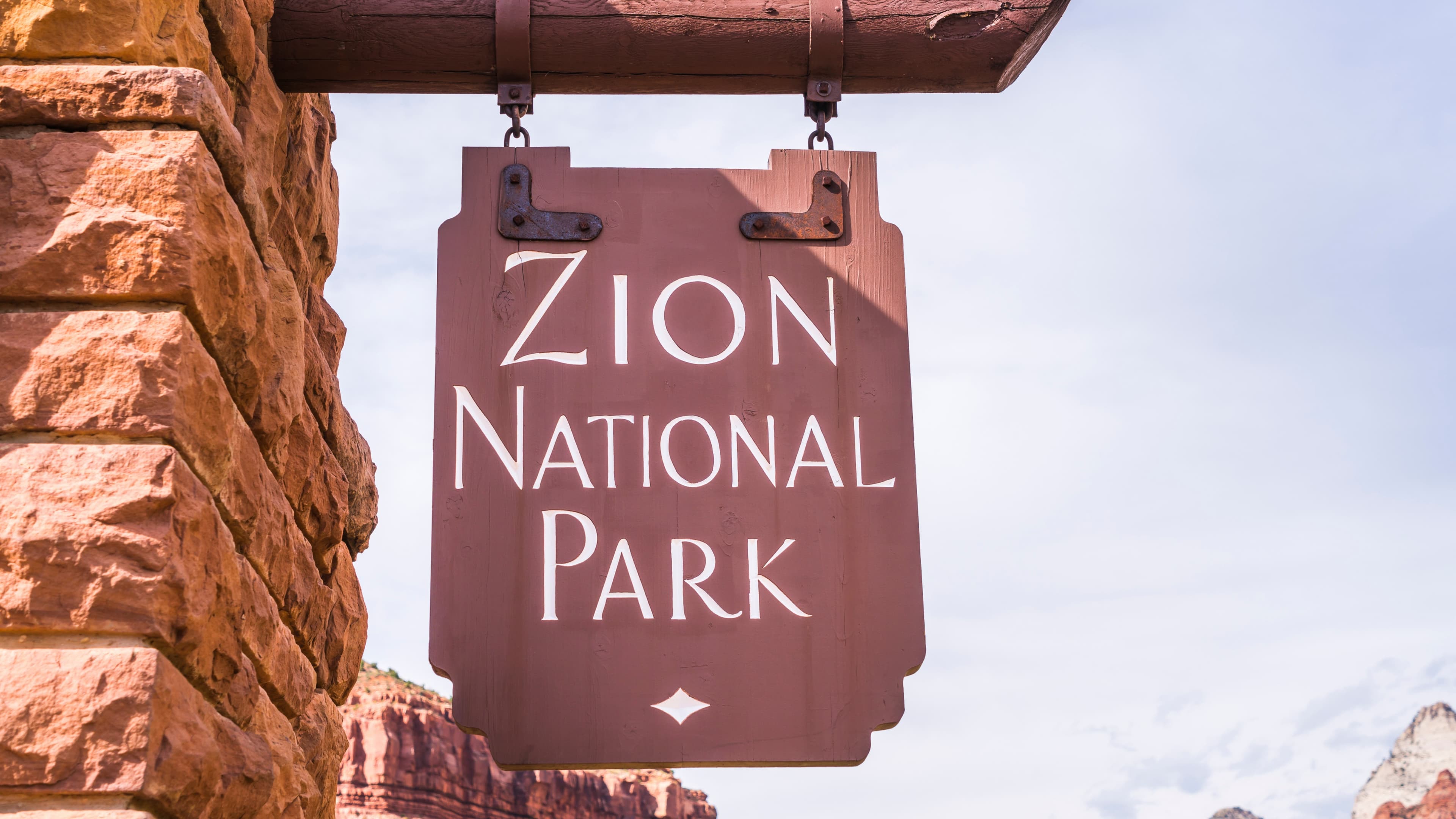
Zion National Park hiking rewards preparation more than almost any other park in the American Southwest. The best hikes in Zion National Park range from paved riverside walks and family-friendly trails to exposed ridge climbs, river hikes, backcountry routes, and technical slot canyons.
Choosing the right Zion hike is not simply about finding the most famous trail. Angels Landing may dominate photos and social media, but it is not the right route for every visitor. The Narrows can be extraordinary one day and inaccessible the next. Some of the best Zion hiking trails are also found outside the crowded main canyon.
The right choice depends on your fitness, experience, weather, season, permits, available time, and tolerance for exposure. If part of your group would rather not hike at all, national parks for non-hikers builds a shared Zion day around the canyon shuttle and a short Pa'rus outing.
This Zion National Park hiking guide covers the major trails by skill level, Angels Landing permits, The Narrows conditions, Zion Canyon Shuttle logistics, the best time to hike Zion, and how to organize a practical 3-day Zion itinerary without spending your best hiking hours waiting for transportation.
Zion National Park Hikes at a Glance
| Trail | Difficulty | Approx. Distance | Permit? | Best For |
|---|---|---|---|---|
| Riverside Walk | Easy | 2.2 mi round trip | No | Families, first-time visitors |
| Pa'rus Trail | Easy | About 3.5 mi round trip | No | Easy walking, bikes, visitors with dogs |
| Watchman Trail | Moderate | 3.3 mi round trip | No | Canyon views, sunrise or evening hiking |
| Lower Emerald Pools | Moderate | 1.2 mi round trip | No | Short scenic hike |
| Canyon Overlook Trail | Moderate | 1 mi round trip | No | Big views with limited mileage |
| Taylor Creek Trail | Moderate | About 5 mi round trip | No | Quieter Kolob Canyons hiking |
| Scout Lookout via West Rim | Strenuous | About 4 mi round trip | No | Angels Landing alternative |
| Angels Landing | Strenuous | 5.4 mi round trip | Yes | Exposure, iconic Zion views |
| The Narrows (Bottom Up) | Variable | Up to 9.4 mi round trip | No | River hiking, slot canyon scenery |
| Observation Point via East Mesa | Strenuous | About 7 mi round trip | No | High-elevation canyon views |
| West Rim Trail | Strenuous | About 14 mi one way | Overnight permit if camping | Backpacking |
| The Subway | Strenuous/Technical | Route dependent | Yes | Wilderness and canyoneering |
Your next hike. Your whole trip. One plan.
Bring your trails, trailheads and the stops in between together with Xavier, your AI adventure companion.
What Makes Zion Different from Other National Parks
Zion's geography creates a planning problem that many national parks do not have. Zion Canyon is narrow, parking is limited, and during shuttle season private vehicles cannot use the Zion Canyon Scenic Drive. Most visitors therefore build their day around Zion shuttle stops and trailheads, not parking lots.
That makes timing part of the hiking experience itself. A perfectly reasonable trail plan can fall apart if you arrive late, cannot park, miss your preferred shuttle, or underestimate how long it takes to move through Zion Canyon.
The canyon walls also create significant differences in sun exposure and temperature. The canyon floor can remain shaded while exposed trails and viewpoints receive direct desert sun. A comfortable morning hike can become substantially harder as temperatures rise.
The Virgin River adds another variable. It forms the route through The Narrows, one of Zion National Park's most famous hikes, but river conditions can change quickly. The Narrows closes when flow exceeds 150 cubic feet per second and can also close when a Flash Flood Warning is issued. Anyone planning a Narrows hike should check current river flow, weather, and flash-flood potential immediately before entering.
Good ideas deserve a place on the map.
See how a hiking trip comes together. Explore a published Xpedition, then shape your own around your dates and pace.

Photo by Sterling Lanier on Unsplash

Photo by Halie West on Unsplash
Canyonlands National Park, Utah
6 Days Backcountry Canyonlands: Needles District Jeep and Backpacking Itinerary
View Xpedition Make it my ownZion National Park Hiking Trails by Difficulty
Easy Hikes in Zion National Park
If you are searching for easy hikes in Zion, short walks for a first visit, or trails suitable for a mixed-ability group, start with these.
Riverside Walk
Riverside Walk is one of the easiest ways to experience the scale of Zion Canyon. The paved trail begins at the Temple of Sinawava and follows the Virgin River for roughly 2.2 miles round trip.
The route is especially popular with families and visitors who want dramatic canyon scenery without a strenuous climb. It is also the approach to The Narrows: once the pavement ends, hikers continuing upstream enter the Virgin River.
Because Riverside Walk and The Narrows share the same access point, this is a useful option when different people in the same group want different levels of difficulty. Some can remain on the paved trail while stronger hikers continue into the river.
Pa'rus Trail
Pa'rus Trail is another strong choice for visitors looking for an accessible, low-commitment Zion hike. It follows the Virgin River near the visitor center and offers wide views of the surrounding canyon formations.
It is particularly important for travelers visiting Zion with a dog. Pa'rus Trail is the only trail in Zion National Park where pets are permitted; pets are not allowed on Watchman Trail or the other hiking trails in the park. Bikes are also permitted on Pa'rus.
If your trip includes a dog and you are looking beyond Zion, Xploreum's guide to best dog-friendly hiking trails in North America covers additional options.
Moderate Hikes in Zion: More Views Without the Biggest Exposure
Watchman Trail
Watchman Trail begins near the Zion Canyon Visitor Center and runs about 3.3 miles round trip. It climbs toward an overlook with broad views across lower Zion Canyon, the Towers of the Virgin, and Springdale.
Because you can reach the trailhead without taking the Zion Canyon Shuttle, Watchman is useful on arrival day, during an evening hike, or when you want to avoid building your schedule around shuttle access.
The trail is exposed in places, so summer hikers should account for heat and limited shade.
Lower, Middle, and Upper Emerald Pools
The Emerald Pools trail system is one of the most popular moderate hiking areas in Zion National Park.
Lower Emerald Pools is roughly 1.2 miles round trip and reaches a sandstone alcove, waterfalls, and pools. From there, hikers can continue toward Middle and Upper Emerald Pools for a longer and steeper outing.
The network works well for groups with different energy levels because you can decide during the hike whether to turn back or continue upward.
Conditions and access within the Emerald Pools trail network can change, so check current trail information before committing to a particular connection.
Canyon Overlook Trail
Canyon Overlook Trail is one of the best short hikes in Zion for the amount of scenery it delivers.
The route begins immediately east of the Zion-Mount Carmel Tunnel and covers about 1 mile round trip with roughly 163 feet of elevation change. It includes rocky terrain, drop-offs, and sections with handrails before reaching a viewpoint over lower Zion Canyon.
Because Canyon Overlook is outside the shuttle-only section of Zion Canyon, it can be combined with east-side driving or a Bryce Canyon transfer day. Parking at the trailhead, however, is extremely limited.
Kayenta Trail
Kayenta Trail connects the Grotto area with the Emerald Pools trail system using a higher route with open canyon views.
It works especially well as part of a loop rather than as a standalone destination. Hikers can climb via Kayenta and return through part of the Emerald Pools network, depending on current trail access.
This is a useful route when you want a moderate Zion hike but do not want to commit to the exposure of Angels Landing.
Taylor Creek Trail
Taylor Creek Trail is in the Kolob Canyons section of Zion National Park, accessed separately from the main canyon.
The route follows the Middle Fork of Taylor Creek toward Double Arch Alcove and offers a very different Zion hiking experience: creek crossings, high canyon walls, historic cabins, and considerably less emphasis on shuttle logistics.
Because Kolob Canyons is about an hour from the Zion Canyon area and does not have park shuttle service, it is best treated as its own half-day or full-day outing.
For travelers searching for less crowded hikes in Zion National Park, Kolob Canyons deserves serious consideration.
Strenuous Zion Hikes: Strong Fitness and Careful Planning
Scout Lookout via West Rim Trail
If you want much of the Angels Landing experience without the final chain section, or if you did not win an Angels Landing permit, Scout Lookout is one of the best Zion hikes without a permit.
Starting from the Grotto, the West Rim Trail climbs through a series of switchbacks, Refrigerator Canyon, and Walter's Wiggles before reaching Scout Lookout.
The route gains more than 1,000 feet and is still strenuous, but hikers can stop at Scout Lookout without an Angels Landing permit. From there, you get expansive views of Zion Canyon and a close look at the ridge leading toward Angels Landing.
Angels Landing
Angels Landing is the most famous hike in Zion National Park, and also one of the park's most demanding hikes psychologically.
The full route is approximately 5.4 miles round trip with 1,488 feet of elevation gain. Most of the climb follows the West Rim Trail to Scout Lookout. The final section then follows a narrow sandstone ridge with chains, substantial exposure, and long drop-offs.
A permit is required for everyone continuing from Scout Lookout onto Angels Landing. You do not need an Angels Landing permit to hike only to Scout Lookout.
Angels Landing is not a route to choose simply because it is famous. Hikers uncomfortable with heights, exposed edges, wet rock, ice, or congested narrow terrain should choose another trail.
The Narrows Hike (Bottom Up)
For many visitors, The Narrows hike is the experience they associate most strongly with Zion.
The standard bottom-up Narrows route starts at the Temple of Sinawava. After hiking the Riverside Walk, you enter the Virgin River and continue upstream between sandstone walls that rise roughly 1,000 feet above the canyon.
The advantage of the bottom-up route is flexibility. You do not need to hike the full distance. Hikers can turn around whenever conditions, time, or energy dictate.
No wilderness permit is required for the bottom-up Narrows route as far as Big Spring. Upstream travel beyond Big Spring is prohibited, and visitors may only travel a limited distance into Orderville Canyon from the Narrows junction.
Conditions matter more here than mileage. Check river flow, flash-flood potential, weather, water temperature, and current park conditions immediately before hiking.
Observation Point via East Mesa Trail
Observation Point is one of Zion's highest major viewpoints and looks across the canyon toward Angels Landing from above.
There is an important planning distinction for anyone researching this hike online: the traditional route from the Weeping Rock area is not currently available. The East Rim Trail no longer connects with Zion Canyon because of major rockfall damage. Current access to the east-rim area requires routes such as East Mesa, Stave Spring, or the East Rim Trailhead.
This is exactly the kind of Zion trail information worth checking again immediately before a trip. Older blog posts can still rank in search long after the access route they describe has changed.
West Rim Trail
The West Rim Trail is one of Zion's strongest options for experienced hikers who want to move beyond the most crowded day-hiking routes.
From the West Rim Trailhead near Lava Point, the route runs roughly 14 miles one way toward the Grotto, depending on the variation used. It crosses high-elevation terrain before dropping dramatically into Zion Canyon.
Camping is limited to designated sites and requires a wilderness permit. Road access near Lava Point can also be seasonal, making transportation part of the planning problem.
Technical and Expert Routes in Zion
The Narrows (Top Down)
The top-down Narrows is a fundamentally different trip from the common bottom-up hike.
The full route starts at Chamberlain's Ranch outside the park and travels approximately 16 miles through the Virgin River Narrows to the Temple of Sinawava. It can be completed as a long single-day trip or as a one-night backpacking trip.
All top-down Narrows trips require a wilderness permit.
Cold water, route length, flash-flood exposure, transportation to Chamberlain's Ranch, and changing river conditions make this a serious wilderness objective rather than simply a longer version of the tourist route.
The Subway (Left Fork of North Creek)
The Subway is one of the most recognizable wilderness destinations in Zion.
The bottom-up Subway route is non-technical in the sense that it does not require rappelling, but it is still a strenuous, off-trail wilderness hike involving route finding, boulders, creek travel, and roughly 9 miles of hiking.
The top-down Subway route is technical canyoneering and requires ropes, harnesses, rappelling skills, cold-water protection, swimming, and route-finding ability.
Both routes require wilderness permits.
Orderville Canyon
Orderville Canyon is a technical canyon route that eventually joins The Narrows.
Experienced groups should expect route finding, water travel, swimming, and canyoneering obstacles. Permits apply to technical canyoneering and through-routes in the Virgin River Narrows and its tributaries.
Zion Trail Closures to Know in 2026
Visitors researching Zion hikes should be cautious with older trail guides.
Hidden Canyon Trail remains closed throughout 2026, along with the damaged East Rim Trail section below Cable Mountain. Major rockfalls affected this area, and the old Weeping Rock access toward Observation Point is not an available route.
Always check current Zion National Park trail conditions shortly before your visit rather than assuming a route is open because it appears in an older itinerary.
Best Time to Visit Zion National Park for Hiking
Spring: March Through May
Spring brings moderate temperatures, wildflowers, waterfalls, and increasing daylight.
It also brings snowmelt. Virgin River flows can become too high for safe Narrows hiking, and The Narrows may close during periods of high spring runoff.
For conventional Zion hiking trails, spring can be excellent. For a trip built specifically around The Narrows, you need a backup plan.
Summer: June Through August
Summer is Zion's busiest and hottest hiking season.
For exposed routes, heat becomes part of the difficulty rating. Plan demanding hikes as early as trail access allows, carry adequate water, and avoid assuming that a relatively short mileage means an easy day.
July through September is also monsoon season in the desert Southwest, when thunderstorms can create serious flash-flood risk in slot canyons and narrow drainages.
Fall: September Through November
For many hikers, fall offers one of the best combinations of temperatures, trail access, and river conditions.
Temperatures begin to moderate, crowds generally ease after the busiest summer period, and lower river flows can improve the chances of hiking The Narrows.
Late October also brings fall color to the cottonwoods along the Virgin River.
Winter: December Through February
Winter is Zion's quietest major season.
The canyon floor can be clear while higher elevations receive snow and ice. Conditions on exposed trails such as Angels Landing can change the risk considerably, especially when sandstone or chains are wet or icy.
The Zion Canyon Shuttle also operates differently in winter, and private vehicles may be allowed onto Zion Canyon Scenic Drive during periods when shuttle service is not running.
Zion Shuttle 2026: Trailhead Access and Parking Strategy
Understanding the Zion Canyon Shuttle is one of the most important parts of planning a Zion hiking itinerary.
For 2026, regular Zion Canyon shuttle service began March 7. Service continues through November 28, followed by a break and holiday service from December 26 through January 2. During regular shuttle season, private vehicles are not allowed on Zion Canyon Scenic Drive.
For most of the main season, the first shuttle from the Zion Canyon Visitor Center leaves at 7 a.m. Shuttles generally arrive every five to ten minutes inside the canyon, but parking at the visitor center can fill early.
The Springdale shuttle provides another option. Visitors can park in Springdale, ride to the pedestrian entrance, enter the park, and transfer to the Zion Canyon Shuttle.
This is often easier than repeatedly circling the visitor-center parking lot.
Remember that Zion National Park itself is open 24 hours a day. There is no meaningful "arrive before the park opens" strategy. The practical objective is to arrive before parking and shuttle demand builds.
Trails in Kolob Canyons, Kolob Terrace, and much of Zion's east side require a different transportation strategy and are generally accessed by private vehicle or private shuttle.
Zion Hiking Permits: What Requires One?
Understanding Zion National Park hiking permits before booking accommodations can save a major itinerary change later.
Angels Landing Permit
Everyone hiking beyond Scout Lookout onto Angels Landing needs a permit.
For 2026, the seasonal lottery windows are:
- Spring hiking: applications February 13 to 25
- Summer hiking: applications April 1 to 20
- Fall hiking: applications July 1 to 20
- Winter hiking: applications October 1 to 20
A day-before lottery is also available. Applications can be submitted from 12:01 a.m. until 3 p.m. Mountain Time on the day before the intended hike, with results issued at 4 p.m.
If you do not win an Angels Landing permit, Scout Lookout remains a strong alternative and does not require one.
The Narrows Permits
The bottom-up Narrows hike from Temple of Sinawava does not require a wilderness permit.
The 16-mile top-down route from Chamberlain's Ranch does require one.
The Subway Permit
Every trip into Left Fork of North Creek, known as the Subway, requires a wilderness permit, including both the bottom-up hiking route and top-down technical route.
Overnight Backpacking
Overnight wilderness trips, including camping along the West Rim Trail, require wilderness permits.
Most conventional Zion Canyon day hikes do not require a separate hiking permit beyond the park entrance fee.
A Practical 3-Day Zion National Park Itinerary
One of the most common Zion itinerary mistakes is trying to stack too many major hikes into the main canyon.
For most first-time visitors, 3 days in Zion National Park gives you enough time to experience the canyon while also seeing one of the park's quieter areas.
Day 1: Easy and Moderate Zion Canyon Hikes
Start with Watchman Trail from the visitor-center area.
Later, ride the shuttle to Temple of Sinawava and hike Riverside Walk. If conditions are suitable and your group is equipped for river travel, you can continue a short distance into The Narrows.
This gives you a strong introduction to Zion without committing your first day to the park's hardest trail.
Day 2: One Major Zion Hike
Choose one primary objective:
Angels Landing if you have a permit and are comfortable with significant exposure.
Scout Lookout if you want the climb and major canyon views without the chain section.
The Narrows if river and weather conditions are good.
Observation Point via the east side if high canyon views are the priority.
Avoid trying to combine several of these simply because they appear close together on a map.
Day 3: Kolob Canyons or Zion's East Side
Leave the main Zion Canyon corridor.
Taylor Creek Trail is a strong Kolob Canyons choice, while Canyon Overlook pairs naturally with an east-side drive.
This produces a much more complete picture of Zion than spending all three days moving between the same shuttle stops.
If you have a fourth day, consider using it for a longer Narrows hike, a permit-dependent wilderness route, or a relaxed recovery day in Springdale.
Planning a Multi-Day Zion Trip With Xavier
The logistics become significantly more complicated when Zion is only one part of a longer trip.
A Zion National Park road trip commonly connects the park with Bryce Canyon, Capitol Reef, Grand Staircase-Escalante, or the Grand Canyon. A Utah Mighty 5 road trip can add Arches and Canyonlands farther east.
Now you are coordinating driving time, trail difficulty, weather, shuttle access, permits, campsites, lodging, fuel, and seasonal conditions across multiple destinations.
Xavier, the AI agent companion at Xploreum, can take your starting point, travel dates, group size, preferred activity level, and trip constraints and turn them into a connected Xpedition. Instead of planning each hike in isolation, Xavier can sequence driving legs, hiking days, trailheads, campsites, accommodations, and stops across the full route.
That becomes particularly useful for a week-long Southwest national parks road trip, where a poor sequence can easily cost several hours of unnecessary driving.
For a broader look at planning tools, see Xploreum's guide to the best apps for hiking and camping trip planning.
What to Carry for Hiking in Zion National Park
Zion's canyon environment can be deceptive. Shade, moving water, and elevation changes can make conditions feel comfortable even while your body is losing significant water.
The National Park Service recommends carrying at least one gallon of water per person per day. Potable water is available at several developed locations including the Zion Canyon Visitor Center, Zion Lodge, the Grotto, and Temple of Sinawava.
Sun protection matters on exposed hikes such as Angels Landing, Scout Lookout, Observation Point, Watchman, and Canyon Overlook.
For The Narrows, wear sturdy closed-toe footwear with good support, use a walking stick or pole for stability, and bring quick-drying layers. Cold-water protection may require a wetsuit or drysuit depending on the season and conditions.
Do not rely on the Virgin River as a convenient drinking-water source. Zion continues to monitor cyanobacteria and cyanotoxins, and the NPS warns hikers not to drink untreated river water.
A headlamp is useful even when you expect to finish in daylight. Weather, shuttle timing, slower hikers, route finding, and injuries can all turn a planned daytime hike into a late return.
Trekking poles can also make Zion's long descents easier on the knees and are particularly useful on uneven terrain.
What should you leave behind? Sandals and unstable footwear for The Narrows, unnecessary weight on exposed climbs, and any plan that depends on cell service being available everywhere.
Connecting Zion to a Larger Southwest Xpedition
Zion sits within one of North America's densest clusters of major outdoor destinations.
Bryce Canyon is roughly 86 miles northeast. Grand Staircase-Escalante stretches across southern Utah to the east. Cedar Breaks National Monument sits north of Zion, while the North Rim of the Grand Canyon is to the south.
Zion is also a natural starting or ending point for a Utah Mighty 5 itinerary connecting Zion, Bryce Canyon, Capitol Reef, Arches, and Canyonlands. For trails across all of Utah's hiking regions, see the best hikes in Utah guide. For a seven-day and a ten-day version of the all-five-parks route, see the Utah Mighty 5 itinerary.
The distances look manageable on a map. The planning challenge is everything layered on top of them: permit dates, seasonal road access, shuttle schedules, hiking recovery time, accommodation availability, weather, campsite reservations, and the fact that your preferred trail may be unavailable on the day you planned it.
If you are building that kind of route, Xploreum's guide to planning a multi-day backcountry trip with campsites and resupply covers the framework for making the logistics work before committing to the trip.
Turn what you read into a trip.
Bring the route, campsites, and stops together with Xavier.
Frequently asked questions
What are the best hikes in Zion National Park?
For first-time visitors, the most recognizable Zion hikes are Angels Landing, The Narrows, Canyon Overlook, Emerald Pools, Watchman Trail, and Observation Point.
The "best" route depends on your fitness, comfort with heights, weather, permits, and how much time you have.
What is the hardest hike in Zion National Park?
Technical routes such as the top-down Subway and longer canyoneering trips demand the most specialized skills.
Among well-known hiking routes, a full top-down Narrows trip, the West Rim Trail, and strenuous wilderness routes require substantially more endurance and logistics than standard day hikes.
Angels Landing is difficult for a different reason: significant exposure and a narrow, chain-assisted ridge.
Do you need a permit for Angels Landing?
Yes.
Everyone hiking from Scout Lookout onto the final Angels Landing section needs a permit. You can hike the West Rim Trail to Scout Lookout without one.
Can you hike The Narrows without a permit?
Yes.
The bottom-up Narrows route from Temple of Sinawava does not require a wilderness permit. The top-down route from Chamberlain's Ranch does require one.
What are the best Zion hikes without a permit?
Popular Zion hikes that normally do not require a hiking permit include Riverside Walk, Pa'rus Trail, Watchman Trail, Emerald Pools, Canyon Overlook, Taylor Creek, Scout Lookout, and the bottom-up Narrows route.
Always check current conditions and closures before hiking.
When is the best time to hike Zion National Park?
Spring and fall generally provide the most comfortable hiking temperatures.
Fall can be particularly attractive for The Narrows because river levels are often lower than during spring runoff. Spring offers excellent conventional hiking conditions but may bring high Virgin River flows.
Summer requires careful heat management and brings monsoon-related flash-flood risk, while winter can introduce snow and ice on higher trails.
Are dogs allowed on Zion National Park hiking trails?
Dogs are allowed on Pa'rus Trail only. They are not permitted on Watchman Trail or other Zion hiking trails, and pets cannot ride park shuttle buses.
Is Hidden Canyon Trail open in 2026?
No. Hidden Canyon Trail remains closed throughout 2026 because of rockfall-related hazards in the East Rim area.
Do you need a reservation to enter Zion National Park?
No general reservation is required to enter Zion National Park or ride the park shuttle, although the normal park entrance fee applies.
Specific activities, including Angels Landing and wilderness routes such as The Subway and top-down Narrows, have separate permit requirements.
How early should you arrive at Zion National Park?
Parking fills early throughout the year.
During much of the 2026 shuttle season, the first Zion Canyon Shuttle leaves the visitor center at 7 a.m. On busy hiking days, arriving early enough to be parked before the first major wave of visitors gives you much more flexibility.
How many days do you need in Zion National Park?
Three days is a strong starting point for a first visit.
It gives you one day for easier Zion Canyon trails, one day for a major hike such as Angels Landing, Scout Lookout, or The Narrows, and one day for Kolob Canyons or the east side.
A fourth or fifth day gives you more flexibility for weather, permits, river conditions, and recovery.
How do you plan a Zion and Bryce Canyon or Utah Mighty 5 road trip?
Start with the constraints that cannot easily move: permit dates, accommodation reservations, seasonal closures, and fixed travel dates.
Then sequence your hiking days around driving distance, expected fatigue, weather, and trail access.
For a multi-park trip, Xavier at Xploreum can build a day-by-day Xpedition from your dates, starting point, group size, activity level, and preferences, coordinating the individual hiking plans into one connected route.
Sources
Rules, closures, fire restrictions, food-storage requirements, water conditions, and permit systems can change. Verify your destination with the managing agency before departure.