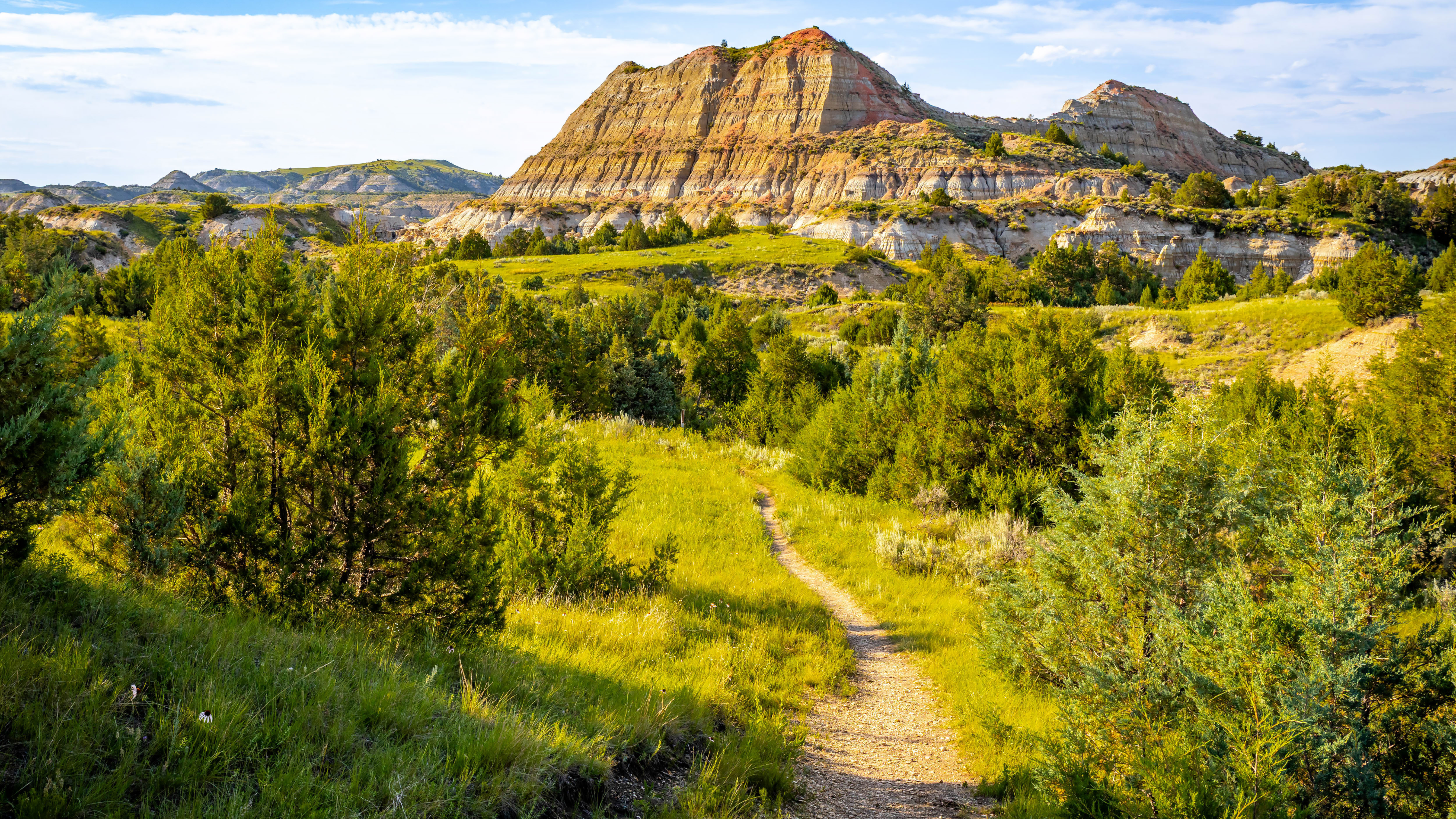
National parks grouped by trail variety, demanding terrain, and ease of access, so you can match the park to your group's skill level and time.
The best national parks for hiking are not all the same kind of experience. Some reward beginners with well-maintained, clearly signed loops. Others demand technical skill, route-finding, and days of self-sufficiency. Choosing the wrong park for your group's skill level or time constraints is one of the most common planning mistakes, and it is fixable before you leave home.
This guide covers ten parks across three dimensions that actually matter for trip planning: trail variety, how demanding the hiking gets, and how easy it is to access the trails you want. Visitation numbers alone do not tell you whether a park fits your trip. These three factors do.
In this guide
- Why Trail Variety, Difficulty, and Access?
- Parks With the Best Trail Variety
- Parks With the Most Demanding Hiking
- Parks That Balance Difficulty and Access
- Parks Worth Knowing for Accessibility and Ease of Entry
- Putting the Xpedition Together
- Frequently asked questions
Why Trail Variety, Difficulty, and Access?
Most "best parks for hiking" lists rank by popularity or total mileage. Those numbers are useful background, but they do not tell you whether the park has options for every member of your group, whether the trails you want require a permit lottery, or whether the trailhead is a two-hour drive from the entrance on a dirt road.
According to Peak Gear Guide, approximately 61 million people in the United States participate in hiking annually, and U.S. national parks recorded 331.9 million recreation visits in 2024. Demand is high. That makes access (permits, parking, road conditions, trailhead logistics) a real constraint, not a footnote.
The parks below are not ranked by a single score. They are grouped by what they do best, so you can match the park to the trip rather than the other way around.
Parks With the Best Trail Variety
Great Smoky Mountains National Park
No park in the system handles sheer trail volume the way the Smokies do. According to knoxnews.com, the park contains nearly 850 miles of official hiking trails, covering everything from paved accessible paths to remote ridgeline routes with 4,000-foot elevation gains. You can walk a flat riverside trail in the morning and be on a challenging summit approach by afternoon.
The variety extends to ecosystems. Old-growth forest, open balds, waterfalls, and historic homesteads all appear within the same park boundary. For groups with mixed skill levels, the Smokies are hard to beat.
Access note: No entrance fee. Most popular trailheads, particularly Alum Cave and Laurel Falls, fill by 8 a.m. on summer weekends. Arrive early or plan for a midweek start.
Olympic National Park
Olympic is genuinely three parks in one. According to backpacker.com, the park features more than 600 miles of trails spread across a temperate rainforest, an alpine zone, and a wild Pacific coastline. Each ecosystem requires different gear and preparation.
The Hoh Rain Forest trails are accessible to most fitness levels. The High Divide Loop and Seven Lakes Basin routes demand solid fitness and navigation skills. The coastal routes along the Wilderness Coast involve timed tidal crossings and require planning that goes well beyond a standard trail map.
Access note: The park spans a large area of the Olympic Peninsula. Driving between ecosystems takes time. Build transit legs into your plan.
North Cascades National Park
Less visited than its neighbors, but technically demanding in ways that reward experienced hikers. The trail network is smaller, but the terrain is serious: glaciated peaks, steep approach routes, and limited infrastructure.
For hikers who want difficulty without the crowds of Rainier or Glacier, North Cascades is worth the planning effort. Most trails require genuine backcountry preparation.
Parks With the Most Demanding Hiking
Grand Canyon National Park
The Grand Canyon inverts the usual hiking logic. You descend first and climb out last, when you are most tired and the temperature is highest. The Bright Angel Trail is the most forgiving inner-canyon route, but "forgiving" is relative at 10 miles round-trip with nearly 3,000 feet of elevation change.
Rim-to-river-to-rim routes like the South Kaibab to North Kaibab corridor span 21 miles one way and require a permit, overnight planning, and water management that most day hikers underestimate. The park service consistently warns against attempting rim-to-river and back in a single day.
Access note: Inner-canyon camping requires a permit through the Grand Canyon Backcountry Information Center. Demand exceeds supply for popular dates. Plan well ahead.
Rocky Mountain National Park
Rocky Mountain offers a full difficulty spectrum, but its high-altitude routes are genuinely hard. The park sits almost entirely above 8,000 feet, and many of the most rewarding hikes push above 12,000 feet. Altitude affects hikers who come from sea level more than they expect.
Longs Peak, at 14,259 feet, is the park's signature challenge. The Keyhole Route is a 15-mile round trip with 5,100 feet of elevation gain, significant exposure, and a weather window that closes fast on summer afternoons. It is not a casual hike.
Access note: A timed entry permit is required for the Bear Lake Corridor during peak season. The permit system is managed through Recreation.gov.
Glacier National Park
Glacier's trail network ranges from gentle lake walks to exposed ridge routes. The Highline Trail, running along the Garden Wall above Going-to-the-Sun Road, is one of the most dramatic ridgeline walks in North America. The park also holds routes that require glacier travel and scrambling skills.
Going-to-the-Sun Road is the park's primary access corridor, and vehicle reservations are required during peak season. Plan the road before you plan the hike.
Parks That Balance Difficulty and Access
Yosemite National Park
Yosemite has the widest difficulty range of any park on this list. The Valley floor trails are flat, paved, and accessible to almost anyone. Half Dome requires a permit lottery, a 16-mile round trip, and the ability to handle cables on near-vertical granite. Most hikers will find something between those two extremes that fits their group.
The challenge with Yosemite is not the trails. It is the logistics. Valley parking is limited. Shuttle systems help but require planning. Wilderness permits for overnight trips are competitive.
Access note: Half Dome permits are issued by lottery through Recreation.gov. Day-hike permits for the cables are separate from overnight permits. Check the current system before your trip date.
Grand Teton National Park
Grand Teton packs serious elevation and dramatic scenery into a compact trail network. The Teton Range rises steeply from the valley floor, which means short approaches with significant vertical gain. Cascade Canyon, Lake Solitude, and the Paintbrush Divide loop are among the most rewarding hikes in the Rockies.
The park is smaller than its neighbors, which makes it easier to cover multiple areas in a single trip. Trailhead access is generally straightforward, with most major routes starting from Jenny Lake or String Lake.
Access note: The Jenny Lake Shuttle reduces round-trip distance on several popular routes. Backcountry camping requires a permit.
Zion National Park
Zion's trail variety is unusual for a park of its size. The Riverside Walk is paved and accessible. The Narrows involves wading through the Virgin River in a slot canyon. Angels Landing has cables and serious exposure. Each trail type requires different gear and preparation.
The park uses a shuttle system for the main canyon, and private vehicles are restricted during peak season. The Narrows and Angels Landing both require permits obtained through a lottery system.
Access note: Angels Landing permits are issued by lottery. The Narrows bottom-up route does not require a permit but does require checking river flow conditions before entry.
Parks Worth Knowing for Accessibility and Ease of Entry
Not every trip calls for maximum difficulty. According to parkverdict.com, 79% of the 589 National Park Service units evaluated do not charge an entrance fee. Many of those units include trails that are genuinely accessible to beginners, families, and hikers with mobility limitations.
Within the fee-charging parks, accessibility varies significantly. Great Smoky Mountains has no entrance fee and includes paved accessible trails near Cades Cove and Laurel Creek Road. Olympic's Hurricane Ridge area offers accessible paved trails with views that match anything in the system. Acadia's carriage road network is one of the most accessible multi-use trail systems in any national park.
For groups that include hikers with different ability levels, these parks are worth researching specifically for their accessible route options, not just their signature difficult hikes.
Putting the Xpedition Together
Picking the right park is the first decision. The harder part is coordinating everything around it: driving legs from your starting point, where to stay the night before a trailhead start, which campgrounds require advance booking, where to resupply, and how the days connect into a complete trip rather than a list of hikes.
That coordination is where most planning time goes. If you are heading to one of the parks above and want to build a complete day-by-day Xpedition around your chosen trails, Xavier at Xploreum can take your trip description and organize routes, driving legs, trailheads, campsites, and stops into one connected plan with an interactive map.
For help choosing the right apps to support your planning and navigation, the best apps for hiking and camping trip planning guide covers the tools most hikers use alongside a full Xpedition. If you are bringing a dog, the best dog-friendly hiking trails in North America guide covers which parks and trails actually accommodate them.
For groups comparing AI-assisted planning options, the best AI trip planning apps for backcountry hiking guide covers what each tool does and where it stops.
Frequently asked questions
Which national park has the most hiking trails?
Great Smoky Mountains National Park has one of the largest trail networks in the system, with nearly 850 miles of official hiking trails according to knoxnews.com. The park covers a wide range of difficulty levels, from short accessible walks to challenging ridgeline routes.
What is the hardest hike in the national park system?
Difficulty depends on the metric. Longs Peak in Rocky Mountain National Park (15 miles round trip, 5,100 feet of gain, significant exposure) and the Grand Canyon rim-to-rim corridor (21 miles one way with extreme heat risk) are consistently cited among the most demanding. Both require advance planning and permits.
Do most national parks charge an entrance fee?
No. According to parkverdict.com, 79% of the 589 National Park Service units evaluated do not charge an entrance fee. The most popular hiking parks (including Yosemite, Grand Canyon, and Rocky Mountain) do charge fees, but Great Smoky Mountains is a notable exception.
How far in advance do I need to plan for permit-required hikes?
Permit timelines vary significantly. Half Dome in Yosemite and Angels Landing in Zion both use lottery systems that open months before the hiking season. Grand Canyon backcountry permits are competitive and require early applications. Check Recreation.gov for current lottery windows for each park.
What is the best national park for hikers with mixed skill levels in a group?
Great Smoky Mountains and Yosemite both offer the widest range of difficulty within a single park. Both have accessible flat trails and serious backcountry routes, allowing different members of a group to choose appropriate options on the same trip.
How does altitude affect hiking difficulty in national parks?
Parks like Rocky Mountain, Grand Teton, and Glacier sit at elevations where altitude significantly affects exertion. Hikers coming from sea level often underestimate the impact. Acclimatizing for a day before attempting high-elevation routes reduces risk. The Grand Canyon presents the opposite problem: heat and dehydration rather than altitude.
Can I use an AI tool to plan a multi-park hiking trip?
Yes, with the right tool. General AI assistants can generate itinerary text but do not coordinate trailheads, driving legs, campsites, and permit logistics into a connected plan. Xavier, the AI agent companion at xploreum.io, builds a day-by-day Xpedition from a plain-language description, organizing the complete journey rather than just listing hikes.