
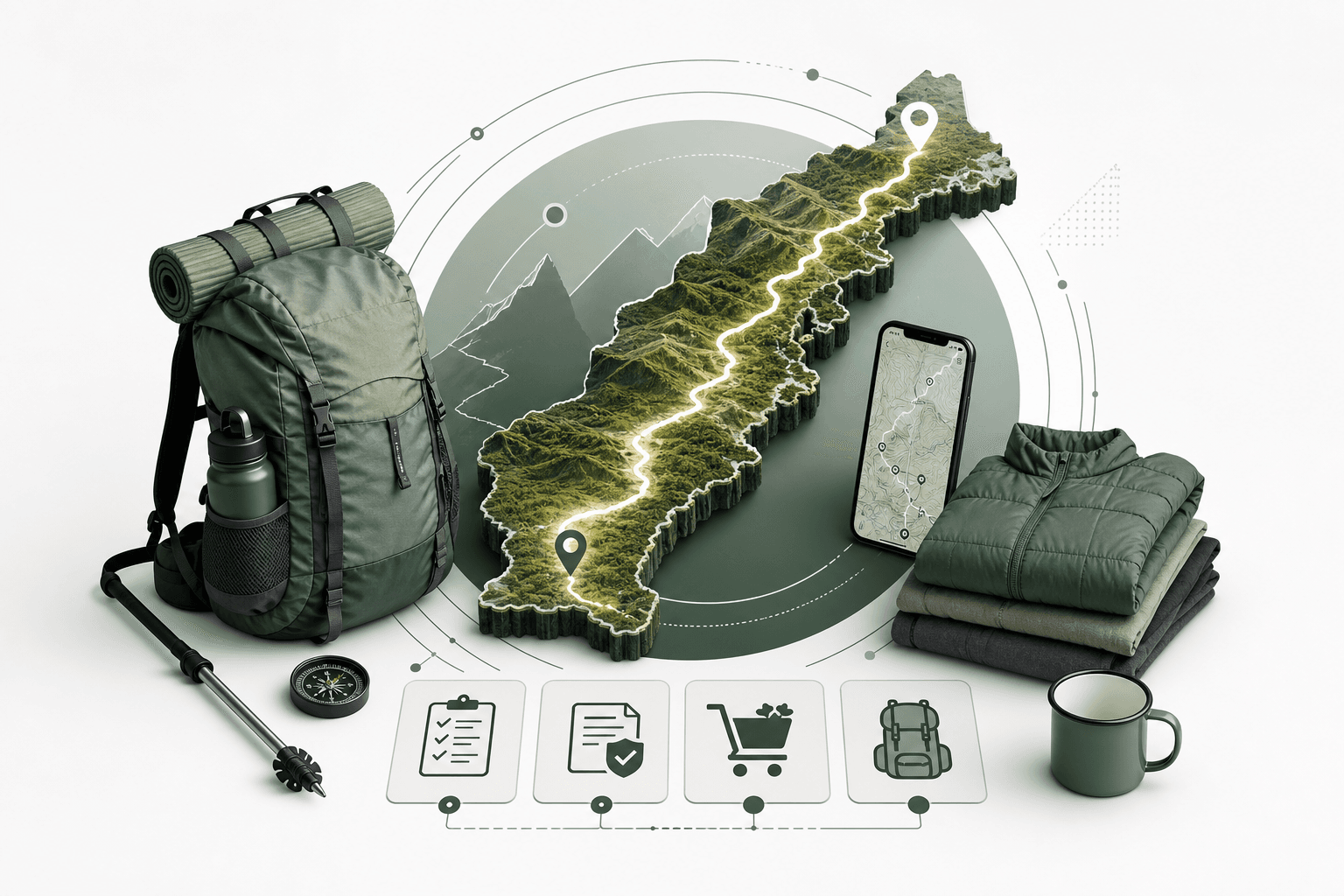
Planning an Appalachian Trail thru hike is not difficult because information is unavailable. It is difficult because the information you need is scattered across permit systems, park websites, resupply guides, trail town resources, shuttle operators, weather forecasts, gear lists, and current trail alerts.
The Appalachian Trail stretches 2,197.9 miles in 2026, running from Springer Mountain in Georgia to Katahdin in Maine and crossing 14 states. Its official mileage changes slightly from year to year as the footpath is relocated, repaired, and remeasured.
Whether you are planning a complete Appalachian Trail thru hike, a one week section hike, or a multi-year effort to eventually cover every mile, the same questions appear quickly.
Which direction should you hike? Which sections require permits? How often should you resupply? How much food should you carry? What gear do you actually need? Where will you sleep? How will you get between trailheads? What happens when a closure or detour changes the route you planned?
This Appalachian Trail planning guide brings those pieces together so that you can build a realistic hiking plan before reaching the trailhead.
Appalachian Trail at a Glance
| Planning Factor | What to Know |
|---|---|
| Official 2026 distance | 2,197.9 miles |
| States crossed | 14 |
| Southern terminus | Springer Mountain, Georgia |
| Northern terminus | Katahdin, Maine |
| Typical thru hike | About 5 to 7 months |
| Most common direction | Northbound, or NOBO |
| Typical food carry | About 3 to 6 days |
| Trail marking | White blazes |
| Trailwide permit | None |
| Section permits | Required in several areas |
| Most difficult terrain | New Hampshire and Maine |
| Major remote section | 100 Mile Wilderness |
Your next hike. Your whole trip. One plan.
Bring your trails, trailheads and the stops in between together with Xavier, your AI adventure companion.
How the Appalachian Trail Is Structured
The Appalachian Trail, commonly called the AT or A.T., follows the Appalachian Mountains from Georgia to Maine.
It crosses Georgia, North Carolina, Tennessee, Virginia, West Virginia, Maryland, Pennsylvania, New Jersey, New York, Connecticut, Massachusetts, Vermont, New Hampshire, and Maine.
Understanding how the trail is structured is one of the first steps in planning because a full thru hike and a five day section hike require very different logistics.
Appalachian Trail Thru Hiking
A thru hike generally means completing the entire Appalachian Trail within a 12 month period.
Most traditional thru hikers walk the trail in one extended journey. According to the Appalachian Trail Conservancy, most complete the trail in approximately five to seven months, with the average taking slightly less than six months.
There are three common strategies.
NOBO, or northbound: Start in Georgia and hike north toward Katahdin. This is the most popular option.
SOBO, or southbound: Start at Katahdin and hike south toward Springer Mountain. This route begins with some of the hardest terrain on the Appalachian Trail.
Flip-flop: Start somewhere in the middle of the trail, hike in one direction, then return to the starting region and complete the remaining section in the opposite direction.
A flip-flop Appalachian Trail thru hike can reduce crowding and provide more flexibility around weather. Harpers Ferry is one of the most popular starting locations for this approach.
Appalachian Trail Section Hiking
Section hiking the Appalachian Trail means completing portions of the trail across multiple trips.
Some section hikers spend several weekends on the trail. Others gradually complete all 2,197.9 miles over many years.
Section hiking offers significantly more flexibility than a thru hike, but each trip requires its own logistical plan.
You need to coordinate:
- Starting trailhead
- Ending trailhead
- Parking
- Shuttle transportation
- Food and water
- Overnight locations
- Section specific permits
- Seasonal gear
- Current closures
- A way back to your vehicle or transportation connection
Completing the Appalachian Trail through section hikes still qualifies hikers for the Appalachian Trail Conservancy's 2,000 Miler recognition program.
Slackpacking
Slackpacking allows you to hike a section of the Appalachian Trail with a light daypack while a shuttle, hostel, friend, or support vehicle transports your overnight gear to another location.
It is particularly practical around trail towns and areas with frequent road crossings.
Slackpacking does not remove the need for planning. Instead, transportation becomes the most important constraint.
Good ideas deserve a place on the map.
See how a hiking trip comes together. Explore a published Xpedition, then shape your own around your dates and pace.

Photo by Michael Denning on Unsplash
Acadia National Park, Maine
3 Days Backpacking Acadia National Park, Maine
View Xpedition Make it my own
Photo by Rich Martello on Unsplash
The Appalachian Trail Through 14 States
Every section of the Appalachian Trail feels different.
Georgia
Georgia contains Springer Mountain, the southern terminus of the Appalachian Trail.
Northbound hikers encounter significant climbing almost immediately. Early season hikers should prepare for cold nights, rain, mud, and occasional winter conditions at elevation.
North Carolina and Tennessee
The trail repeatedly crosses between North Carolina and Tennessee and passes through Great Smoky Mountains National Park.
The southern Appalachians combine steep elevation changes, high ridges, unpredictable spring weather, and some of the most popular sections of the entire AT.
Virginia
Virginia contains more Appalachian Trail mileage than any other state.
The trail passes through areas including Mount Rogers, McAfee Knob, the Virginia Triple Crown region, and Shenandoah National Park.
Because of its length, Virginia can become a psychological milestone for thru hikers. For section hikers, however, it provides dozens of possible itineraries.
West Virginia and Maryland
Harpers Ferry is one of the most important locations on the Appalachian Trail and is home to the Appalachian Trail Conservancy headquarters.
The surrounding West Virginia and Maryland sections are comparatively short and can work well for hikers planning shorter AT section hikes.
Pennsylvania
Pennsylvania is famous among Appalachian Trail hikers for long stretches of rocky terrain.
Footwear, foot care, and daily mileage deserve more attention here than distance alone might suggest.
New Jersey and New York
The trail becomes more closely connected to towns, roads, and populated areas.
That can make transportation and resupply easier, but the hiking is not necessarily easy. Both states still contain steep and rugged sections.
Connecticut and Massachusetts
These New England sections combine forest, small trail towns, river valleys, and increasingly significant elevation.
Vermont
For roughly 100 miles, the Appalachian Trail shares its corridor with Vermont's Long Trail.
Mud can significantly affect trail conditions, particularly during wet seasons.
New Hampshire
New Hampshire introduces some of the most demanding terrain on the Appalachian Trail.
The White Mountains and Presidential Range combine steep climbs, exposed terrain, rapidly changing weather, and long days above treeline.
This section requires much more serious weather planning than the trail's relatively modest elevations might suggest.
Maine
Maine contains rugged, remote terrain, numerous water crossings, the 100 Mile Wilderness, and finally Katahdin.
For northbound thru hikers, it is the last major challenge. For southbound hikers, it is the beginning.
Appalachian Trail Permits and Regulations
One of the most common Appalachian Trail planning questions is whether you need a permit.
There is no single permit required to hike the entire Appalachian Trail.
The Appalachian National Scenic Trail itself does not charge an entrance fee. However, the trail passes through many parks, forests, and other public lands that maintain their own permit, camping, parking, and reservation rules.
That means your Appalachian Trail permit requirements depend on the section you are hiking.
Baxter State Park and Katahdin Permits
Katahdin is the northern terminus of the Appalachian Trail and one of the most logistically important locations on the route.
All Appalachian Trail long-distance hikers who plan to summit Katahdin must obtain a Long-Distance Hiker Permit.
This applies to northbound hikers, southbound hikers, section hikers, and flip-flop hikers.
The permit is free and must be obtained in person at the Katahdin Stream Campground ranger station before the summit attempt.
This is different from a Katahdin Trailhead Pass, which applies to many visitors arriving by vehicle for day hiking.
If Katahdin is part of your plan, do not treat the final summit like an ordinary Appalachian Trail day. Weather, park rules, transportation, camping, and trail access all need to align.
Great Smoky Mountains National Park Permit
Great Smoky Mountains National Park requires permits and reservations for backcountry camping.
In 2026, the Appalachian Trail thru-hiker permit costs $44.50 and covers eligible thru hikers for up to eight days and seven nights in the park.
The permit system transitioned to Recreation.gov in April 2026.
Hikers must follow designated backcountry camping rules and use the park's food storage systems.
For anyone planning an Appalachian Trail section hike through the Smokies, permit confirmation should happen before finalizing transportation and overnight plans.
Shenandoah National Park Permit and Entrance Requirements
Shenandoah National Park contains roughly 100 miles of the Appalachian Trail.
Visitors entering Shenandoah must have an entrance pass, including hikers entering the park on foot from the boundary. Overnight backcountry camping also requires a separate backcountry camping permit.
Shenandoah's backcountry permit system is now handled through Recreation.gov.
This corrects an important misconception in some older Appalachian Trail guides. Being a thru hiker does not automatically mean you can ignore Shenandoah's current entrance and camping requirements.
Delaware Water Gap National Recreation Area
The Appalachian Trail passes through the Delaware Water Gap region along the New Jersey and Pennsylvania border.
Camping rules vary by location, and hikers should verify current designated camping areas before beginning the section.
This is especially important on busy weekends, when popular camping locations can become crowded.
White Mountain National Forest
The White Mountains require more planning than most Appalachian Trail sections because weather, elevation, camping restrictions, huts, and shelter availability can all influence the itinerary.
The Appalachian Mountain Club operates huts and campsites throughout parts of the region. For a first stay rather than a thru hike, see your first White Mountains hut trip, which compares one hut with two.
Do not assume that a shelter, hut, or tent site will fit neatly into your expected daily mileage. In New Hampshire, terrain often determines your pace more than distance does.
2026 Appalachian Trail Closures and Detours
A current Appalachian Trail planning guide should account for one reality that static itineraries often miss: the trail changes.
Hurricane Helene caused severe damage across portions of the southern Appalachian Trail in 2024, and some effects remain in 2026.
As of September 2026, hikers should pay particular attention to active ATC alerts involving the Nolichucky River, the Virginia Creeper Trail, and other localized closures or detours. The Virginia Creeper Trail closure north of Damascus is expected to remain in place until the repaired trail reopens in 2027.
The Harpers Ferry footbridge also remained temporarily closed in early September 2026 while stairway work was being completed.
Do not build a multi-day Appalachian Trail itinerary from an old GPX file and assume every mile is unchanged.
Check current Appalachian Trail Conservancy trail alerts shortly before departure and again while you are on the trail.
Appalachian Trail Resupply Strategy
For many hikers, Appalachian Trail resupply planning becomes more complicated than gear selection.
The basic question is straightforward: how much food are you comfortable carrying, and where can you buy or collect more?
Most Appalachian Trail hikers carry approximately three to six days of food at a time because resupply is available relatively frequently along much of the trail.
Carrying substantially more food than necessary increases pack weight. Carrying too little creates pressure to hike faster than planned or leave the trail unexpectedly.
Your resupply strategy should match your expected pace, section, dietary needs, and tolerance for carrying weight.
Appalachian Trail Trail Towns and Resupply Stops
The Appalachian Trail passes through or near dozens of trail towns.
Some offer large supermarkets, outfitters, hostels, restaurants, laundry, and shuttle services. Others may have little more than a small convenience store or post office.
Common Appalachian Trail resupply locations include:
- Hiawassee, Georgia
- Hot Springs, North Carolina
- Damascus, Virginia
- Waynesboro, Virginia
- Harpers Ferry, West Virginia
- Duncannon, Pennsylvania
- Hanover, New Hampshire
- Monson, Maine
The right resupply stops depend on your pace. A location that works perfectly for a hiker averaging 18 miles per day may make little sense for someone averaging 10 miles per day.
That is why copying someone else's Appalachian Trail resupply schedule rarely works perfectly.
Appalachian Trail Mail Drops
A mail drop is a box of food, medication, replacement equipment, or other supplies that you send to a post office, hostel, outfitter, or other receiving location before you arrive.
Mail drops work particularly well when you need:
- Specific dietary products
- Prescription medication
- Replacement shoes
- Seasonal gear
- Specialized backpacking food
- Equipment that may not be available locally
The disadvantage is timing. Post office hours, unexpected zero days, injuries, weather delays, and changing hiking pace can all interfere with a rigid mail drop schedule.
For many Appalachian Trail thru hikers, a hybrid strategy works better. Buy food in trail towns when convenient and use mail drops only where they solve a specific problem.
Resupplying for the 100 Mile Wilderness
The 100 Mile Wilderness in Maine is one of the Appalachian Trail's most famous logistical challenges.
Monson is the traditional final major resupply point for northbound hikers before entering the region.
How much food you need depends on your pace. A faster experienced hiker may require considerably less than someone planning shorter daily mileage.
Rather than automatically packing a fixed number of days, calculate expected trail miles divided by realistic daily mileage to get the food days required, then add an appropriate safety margin.
Calorie density becomes particularly important here because several additional days of low calorie food can create a heavy pack without providing enough energy.
For a deeper look at this process, see Xploreum's guide to planning multi-day backcountry trips with campsites and resupply.
Appalachian Trail Gear List
An Appalachian Trail gear list should be built around the section, season, expected weather, and experience of the hiker.
The Appalachian Trail is not a technical mountaineering route, but it involves prolonged exposure to rain, cold, heat, humidity, mud, rocky terrain, and thousands of feet of repeated climbing and descending.
The most common gear mistake is not usually forgetting something. It is carrying too much.
The Appalachian Trail Conservancy notes that hikers often reduce their full pack weight to approximately 20 to 35 pounds or less once winter equipment is no longer necessary.
The Big Three: Shelter, Sleep System, and Backpack
Backpacking discussions often refer to the big three: shelter, sleep system, and backpack. These items make up a large portion of your base weight.
Shelter. Even though the Appalachian Trail has an extensive shelter system, you should carry your own shelter. Shelters can be full, temporarily closed, inconveniently located, or occupied by hikers who arrived before you. Lightweight tents, trekking pole tents, tarps, and hammocks are all common choices.
Sleep system. Choose your sleeping bag or quilt based on the coldest realistic conditions for the section and season. Do not select a sleeping system only by looking at average temperatures in the nearest town. Higher elevations can be substantially colder.
Backpack. Your backpack should fit the equipment you actually need. Buying an oversized pack often encourages carrying unnecessary gear. Many Appalachian Trail hikers use backpacking packs in the general range of 40 to 60 liters, but there is no universal correct capacity. Fit and total carried weight matter more than the number printed on the pack.
Appalachian Trail Footwear
There is no single best shoe for the Appalachian Trail.
Trail runners are popular because they are light and dry relatively quickly. Hiking shoes and boots can provide additional structure and protection on rocky terrain.
What matters most is fit. Your feet can swell during a long-distance hike, and a shoe that feels perfect during a short test may become uncomfortable after repeated 15 mile days.
A full Appalachian Trail thru hike will usually require replacing footwear multiple times. Do not assume the pair you wear at Springer Mountain will also reach Katahdin.
Rain Gear
The Appalachian Trail is wet.
A reliable waterproof shell belongs in almost every multi-day Appalachian Trail gear list.
Cold rain deserves particular attention. Being wet during warm summer conditions is uncomfortable. Being wet at elevation when temperatures fall can become dangerous.
Rain pants, a rain skirt, an umbrella, or other additional protection may be appropriate depending on the section and season.
Water Treatment
Water is available frequently along much of the Appalachian Trail, but that does not mean every source is safe to drink untreated.
Carry a reliable filter or purification method. A backup treatment method is also useful in case your primary filter fails.
Water availability changes with weather and season. During dry conditions, the distance between reliable water sources can become much more important than the normal guidebook spacing suggests.
Bear Canisters and Food Storage
Food storage rules vary significantly along the Appalachian Trail. This is one section where hikers should avoid following one rule for all 2,197.9 miles.
For example, hard-sided bear canisters are required seasonally between Jarrard Gap and Neel Gap in Georgia. In Great Smoky Mountains National Park, backcountry hikers use the food storage cables provided at designated sites. Other areas have their own requirements.
Beginning May 1, 2026, overnight visitors entering the Pemigewasset Wilderness in New Hampshire must use an approved hard-sided bear canister. Hikers staying strictly on the Appalachian Trail where it skirts the wilderness are not subject to that specific requirement.
The Appalachian Trail Conservancy strongly recommends hard-sided bear canisters for overnight hikers because they are among the most reliable food storage methods.
Always verify the rule for the exact section you plan to hike.
Putting Appalachian Trail Logistics Together
The hardest part of planning an Appalachian Trail hike is not researching any individual piece. It is getting all the pieces to work together.
For a five day section hike, your plan might need to coordinate:
- Driving to the trail region
- Overnight parking
- Starting trailhead
- Ending trailhead
- Shuttle availability
- Daily mileage
- Elevation gain
- Water sources
- Shelters and campsites
- Permit requirements
- Food carries
- Resupply locations
- Weather
- Trail closures
- Backup routes
- Transportation after the hike
For a five or six month thru hike, the same system repeats continuously.
That is why Appalachian Trail planning is not really one itinerary. It is a sequence of smaller trips that change as your pace, weather, body, equipment, and priorities change.
Planning an Appalachian Trail Xpedition With Xavier
Xavier, the AI agent companion at Xploreum, can help coordinate the logistics around an Appalachian Trail section or longer hiking trip.
You can provide your starting location, dates, group size, expected hiking pace, preferred section, and trip constraints.
Xavier can then help structure a day-by-day Xpedition that connects driving legs, trailheads, accommodations, resupply stops, and other travel logistics on an interactive map.
Xavier is not intended to replace dedicated on-trail navigation tools such as FarOut, Gaia GPS, or another offline navigation system.
Its role is different. It handles the planning layer around the hike, where transportation, timing, route access, stops, accommodations, and other logistics need to fit together.
If you are planning an Appalachian Trail section and want to organize the full trip around your dates and pace, you can start with Xavier at app.xploreum.io/chat.
For a deeper comparison of planning tools, see Xploreum's guide to the best AI trip planning apps for backcountry hiking.
Best Time to Hike the Appalachian Trail
When you hike matters as much as where you hike.
Northbound Appalachian Trail Thru Hike
Most NOBO Appalachian Trail thru hikers begin in Georgia in March or early April.
They generally aim to reach Katahdin by September or early October, before increasingly severe weather affects summit access.
Starting too early increases exposure to winter conditions in the southern mountains. Starting too late compresses the time available to reach Maine.
Southbound Appalachian Trail Thru Hike
SOBO hikers start after Katahdin trails open for the hiking season.
This approach immediately introduces hikers to Maine and New Hampshire, some of the most difficult terrain on the entire Appalachian Trail.
The Appalachian Trail Conservancy recommends a southbound thru hike primarily for hikers who already have considerable backpacking experience in difficult terrain.
Flip-Flop Thru Hike
A flip-flop itinerary can offer a wider weather window and fewer crowds.
Harpers Ferry is a common starting point, but other variations are possible.
For hikers who are not attached to the traditional Springer to Katahdin sequence, this can be one of the most flexible ways to complete the Appalachian Trail.
Appalachian Trail Section Hiking
Section hikers have far more seasonal flexibility.
Spring can work well in the Mid-Atlantic while higher northern terrain is still dealing with snow.
Summer provides greater access in New England but can be hot and humid farther south.
Fall can be excellent for sections in Virginia, the Mid-Atlantic, and New England, although daylight becomes shorter and high elevation weather becomes less predictable later in the season.
Frequently asked questions
How long is the Appalachian Trail in 2026?
The official Appalachian Trail length for 2026 is 2,197.9 miles.
The mileage changes slightly over time because of trail relocations, construction, storm damage, and more precise measurements.
Where does the Appalachian Trail start and end?
The southern terminus is Springer Mountain in Georgia. The northern terminus is Katahdin in Baxter State Park, Maine.
How long does it take to thru hike the Appalachian Trail?
Most Appalachian Trail thru hikes take approximately five to seven months, with the average finishing slightly under six months.
Your actual time depends on pace, weather, rest days, injuries, route choices, and hiking direction.
Do you need a permit to hike the Appalachian Trail?
There is no single trailwide Appalachian Trail permit.
However, some sections require permits, reservations, entrance passes, camping fees, or other approvals.
Great Smoky Mountains National Park, Shenandoah National Park, and Baxter State Park are among the locations where hikers need to understand section specific rules.
How much food do Appalachian Trail hikers carry?
Most hikers carry approximately three to six days of food at a time across much of the trail.
Remote sections may require a longer carry.
What is the hardest section of the Appalachian Trail?
The White Mountains in New Hampshire and the rugged terrain of Maine are generally considered among the most difficult parts of the Appalachian Trail.
Steep climbs, rocky terrain, exposed ridges, weather, and more limited resupply options all contribute.
What is the 100 Mile Wilderness?
The 100 Mile Wilderness is a remote section of the Appalachian Trail in Maine between the Monson region and Baxter State Park.
Northbound hikers normally complete a major resupply in Monson before entering.
Despite the name, access roads exist in parts of the region. However, hikers should still plan it as a remote backpacking section rather than depending on easy access to towns or conventional resupply.
Can you section hike the Appalachian Trail instead of thru hiking it?
Yes.
Many hikers complete the Appalachian Trail over multiple years.
The Appalachian Trail Conservancy recognizes hikers who complete the entire trail through section hiking as 2,000 Milers, just as it recognizes those who complete a thru hike.
What is NOBO on the Appalachian Trail?
NOBO means northbound.
A NOBO Appalachian Trail thru hike starts at Springer Mountain in Georgia and finishes at Katahdin in Maine.
It is the most common direction for Appalachian Trail thru hikers.
What is SOBO on the Appalachian Trail?
SOBO means southbound.
A SOBO hike starts at Katahdin in Maine and finishes at Springer Mountain in Georgia.
Because SOBO hikers immediately encounter Maine and the White Mountains, this direction generally demands more backpacking experience from the beginning.
What apps should you use for the Appalachian Trail?
Many AT hikers use FarOut for trail specific navigation and recent hiker information.
Gaia GPS, AllTrails, weather tools, official ATC resources, and other specialized apps can supplement the trip.
For logistics beyond the footpath itself, Xavier can help connect trailheads, transportation, accommodations, resupply stops, and other elements into a larger Xpedition.
How should you plan an Appalachian Trail section hike?
Start with four fixed questions: where will you enter the trail, where will you leave it, where will you sleep and resupply, and how will you get back to your transportation?
Then check permits, expected daily mileage, elevation, water availability, current trail conditions, and weather.
Finally, build a backup plan for the pieces most likely to change.
For additional planning approaches, Xploreum's guide to adventure planning tools used by expedition hikers covers tools that can help coordinate the larger trip.
Final Thoughts
The Appalachian Trail rewards preparation, but good planning does not mean predicting every day of a five month journey.
It means understanding which constraints matter and knowing what to check when conditions change.
Confirm your permits. Understand your food carries. Keep your pack realistic. Know how you will reach and leave each section. Download your navigation resources. Check current trail alerts. Give yourself enough flexibility to respond to weather, closures, injuries, and changes in pace.
For a section hike, that preparation can turn five complicated days into one coherent trip.
For an Appalachian Trail thru hike, the process is the same. You simply repeat it, adapt it, and keep moving north, south, or both until you have covered all 2,197.9 miles.
Turn what you read into a trip.
Bring the route, campsites, and stops together with Xavier.
Sources
Rules, closures, fire restrictions, food-storage requirements, water conditions, and permit systems can change. Verify your destination with the managing agency before departure.