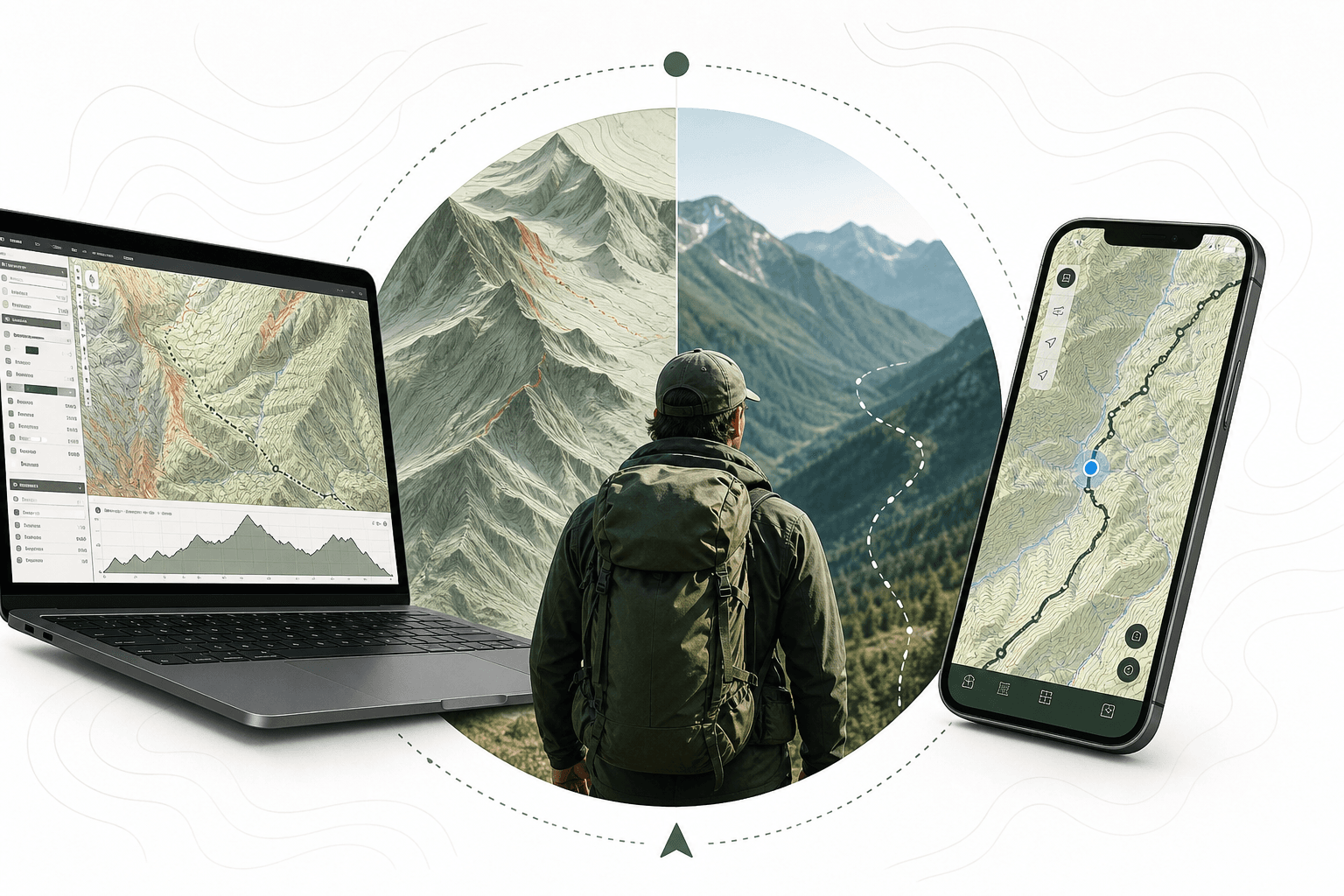
CalTopo wins at pre-trip terrain analysis. Gaia GPS wins in the field. Here's how to choose, or use both.
The CalTopo vs Gaia GPS question comes up constantly among off-trail travelers, guides, and search and rescue volunteers, and for good reason. The choice is not about which app has more features. It is about which one fits how you actually navigate in the backcountry.
Both tools are built for serious off-trail navigation. Both offer offline topographic maps and the kind of depth that AllTrails simply does not provide. But they approach the problem differently, and that difference matters when you are 15 miles from the nearest trailhead with no cell signal and a route that follows no marked path.
This comparison covers what each platform does well, where each one stops, and how to decide which belongs in your kit.
In this guide
- What CalTopo Is Built For
- What Gaia GPS Is Built For
- Head-to-Head: The Decisions That Actually Matter
- Pricing and Subscription Structure
- Which One Should You Choose?
- Where Mapping Tools End and Trip Planning Begins
- How to Read This Comparison Honestly
- Frequently asked questions
What CalTopo Is Built For
CalTopo started as a web-based mapping tool built around precision. It was developed by search and rescue professionals and backcountry travelers who needed more control over map layers, custom route drawing, and terrain analysis than any consumer app offered at the time.
The core strength is desktop-first map building. You can layer USGS topographic maps, aerial imagery, slope angle shading, avalanche terrain overlays, and custom data in combinations that no other consumer tool matches. The slope angle shading feature alone justifies the subscription for anyone traveling in avalanche terrain. It color-codes terrain by angle, which makes route selection significantly more informed.
CalTopo also handles map printing better than any competitor. If you need a custom paper map for a specific drainage or ridge system, CalTopo produces it cleanly at any scale. For an Xpedition where you want a physical backup, that matters.
The mobile app exists and works, but it is clearly secondary to the desktop experience. Route planning happens on a laptop. The phone is for navigating in the field against a map you built earlier.
What CalTopo Does Well
- Layering flexibility: Combine USGS topo, satellite, slope angle, custom KML, and other overlays simultaneously
- Slope angle shading: Color-coded terrain steepness for avalanche and route-safety assessment
- Custom map printing: Print precise paper maps at any scale for any area
- GPX import and export: Clean, reliable file handling for routes built elsewhere
- Collaboration tools: Share maps with partners, guides, or SAR teams with edit access
- Measurement tools: Precise distance, elevation gain, and area calculations
- Desktop interface: The most capable map-building environment available to non-professional users
Where CalTopo Stops
The mobile experience is functional but not fluid. Navigation in the field is possible, but the app does not feel purpose-built for one-handed use on a moving trail. Offline map downloads are available but require deliberate setup before you leave. The interface has a learning curve that casual hikers will find steep. If you have never used it, plan to spend real time with it before a trip depends on it.
What Gaia GPS Is Built For
Gaia GPS is built around field navigation. The mobile app is the primary product, and it shows. The interface is designed for use with gloves, in low light, and under physical stress. Route following, waypoint management, and offline map access are all faster to reach than in CalTopo.
The map library is extensive. Gaia GPS aggregates USGS topo, National Geographic Trails Illustrated, Forest Service motor vehicle use maps, satellite imagery, and international topo layers. For Xplorers crossing land agency boundaries or moving between national forests, wilderness areas, and private land, that breadth is a real advantage.
Track recording is where Gaia GPS earns its reputation. The app records your actual path with high accuracy, logs elevation, and stores the track for later review or sharing. For off-trail travel where you need to retrace your route or document where you actually went versus where you planned to go, that track log is often more useful than the planned route itself.
The community layer shows user-submitted waypoints, campsites, water sources, and conditions. Quality varies, but in popular backcountry areas the community data adds context that no official map provides.
For a closer look at Gaia GPS on its own, including how it holds up against AllTrails, onX Backcountry, and Komoot, see the full Gaia GPS review.
What Gaia GPS Does Well
- Mobile-first navigation: Interface optimized for field use, one-handed operation, and gloved hands
- Track recording: Accurate, reliable GPS track logging with elevation data
- Map library breadth: Aggregates more map sources than any single competitor, including international topo layers
- Offline maps: Straightforward download process, reliable in the field
- Waypoint management: Fast to create, label, and navigate to waypoints mid-trip
- Community data: User-submitted campsites, water sources, and trail conditions in high-traffic areas
- Cross-platform sync: Routes and tracks sync reliably between iOS, Android, and web
Where Gaia GPS Stops
The desktop map-building experience is less powerful than CalTopo. Slope angle shading is not available natively. Custom layer combinations are more limited. For pre-trip route analysis in technical terrain, Gaia GPS gives you less to work with. The premium subscription is required for most of the features that make it worth using over a free alternative, and the breadth of the map library means managing which maps are downloaded requires attention before you leave.
Head-to-Head: The Decisions That Actually Matter
Pre-Trip Route Planning
CalTopo wins here. The desktop interface, slope angle shading, and layering flexibility give you more information for building a route in complex terrain. If you are planning a multi-day off-trail traverse through avalanche terrain, a technical ridge route, or any line where terrain analysis matters before you commit, CalTopo is the better planning environment.
Gaia GPS is adequate for pre-trip planning but not exceptional. It works well for routes that follow established paths or lightly off-trail lines where the primary need is knowing where to go, not analyzing why a specific line is safe or efficient.
In-Field Navigation
Gaia GPS wins here. The mobile app is faster, more intuitive under pressure, and better designed for the conditions you actually navigate in. Track recording runs reliably in the background. Waypoints are easy to manage. Offline maps load quickly.
CalTopo's mobile app will get the job done, but it requires more deliberate interaction. That is a real cost when you are tired, cold, and trying to make a decision quickly.
Offline Reliability
Both platforms support offline maps. Gaia GPS has a simpler, more reliable download workflow. CalTopo offline maps work but require more setup. For Xplorers who are meticulous about pre-trip preparation, CalTopo's offline performance is fine. For those who sometimes forget to download maps until the night before, Gaia GPS is more forgiving.
Avalanche and Technical Terrain
CalTopo wins decisively. Slope angle shading is a genuine safety tool, not a cosmetic feature. No other consumer mapping app provides equivalent terrain analysis in a single layer. If your routes regularly cross avalanche terrain, CalTopo is not optional.
International Travel
Gaia GPS has a broader international map library. If you are traveling outside the United States and need reliable topo coverage, Gaia GPS is more likely to have what you need. CalTopo's coverage is strongest in North America.
Sharing and Collaboration
CalTopo's collaboration tools are stronger for sharing editable maps with partners or guides. Gaia GPS sharing is functional but primarily read-only. For group Xpeditions where multiple people need to contribute to a route, CalTopo handles that workflow better.
Pricing and Subscription Structure
Both platforms run on subscription models. Pricing for both changes periodically, so check each platform's current pricing page before committing. What matters more than the specific number is what each tier actually unlocks.
For CalTopo, the free tier is genuinely useful for desktop map building. Paid tiers add offline maps, additional map sources, and advanced printing. For Gaia GPS, the free tier is limited enough that most serious users will need a premium subscription to access the map library and features that make the app worth carrying.
Neither platform is expensive relative to the cost of a backcountry trip. The question is not which is cheaper. It is which one you will actually use well.
Which One Should You Choose?
The answer depends on how you travel and where your planning happens.
Choose CalTopo if:
- You plan technical routes in avalanche terrain
- You do most of your route building on a desktop before the trip
- You need custom paper maps for areas without reliable cell or satellite coverage
- You collaborate with partners, guides, or SAR teams who need editable map access
- Precision terrain analysis is part of your pre-trip process
Choose Gaia GPS if:
- You navigate primarily from your phone in the field
- You travel internationally or across varied land agency boundaries
- Track recording and post-trip route review are part of how you document trips
- You want a single app that handles both planning and navigation without a steep learning curve
- You rely on community-submitted waypoints and conditions data
Use both if:
You plan in CalTopo and navigate in Gaia GPS. This is the setup many serious backcountry travelers use. Build the route in CalTopo, where the terrain analysis tools are strongest, export the GPX, import it into Gaia GPS, and navigate from there. The two platforms handle GPX exchange cleanly.
Neither tool is a complete trip planning system. Both are navigation tools. They tell you how to move through terrain. They do not help you organize the Xpedition around that terrain: how to reach the trailhead, where to camp before or after the technical section, what to resupply and where, or how the driving legs connect to the route.
That gap is worth understanding before you start planning. You can read more about how to read a topographic map for backcountry navigation as a foundation for getting the most from either platform.
Where Mapping Tools End and Trip Planning Begins
CalTopo and Gaia GPS are both strong tools for what they do. Neither was designed to coordinate a complete multi-day outdoor journey.
The problem most backcountry hikers face is not finding a route. It is connecting the route to everything else: the drive to the trailhead, permit requirements, the campsite sequence, resupply logistics, gear decisions, the group's skill level, and contingency plans if conditions change. That coordination work happens in a different layer entirely, usually across a combination of apps, spreadsheets, and browser tabs.
If you want to see how serious hikers and overlanders are handling that coordination layer, the best apps for remote hiking, campsites, and resupply planning covers the current toolkit honestly, including where each tool stops.
For the broader planning stack, top adventure planning tools for overlanders and expedition hikers covers how mapping tools fit into a complete trip preparation workflow.
Xavier, Xploreum's AI agent companion, approaches this from the other direction. You describe your trip in plain language (starting point, destination, skill level, group size, vehicle, preferred activities), and Xavier builds a complete Xpedition organizing driving legs, trailheads, campsites, accommodations, fuel stops, and meal stops into one connected journey with an interactive map. It does not replace CalTopo or Gaia GPS for in-field navigation. It handles the coordination layer that neither mapping tool was designed for.
If you are planning a trip more complex than anything you have done before, chat with Xavier at app.xploreum.io/chat to see what a complete Xpedition looks like before you start building your route in CalTopo.
How to Read This Comparison Honestly
A few things worth stating directly.
Both platforms have improved significantly in 2026. Gaia GPS has added features that close some of the gap with CalTopo on the planning side. CalTopo has improved its mobile experience. Neither is standing still.
The "use both" answer is not a hedge. It reflects how experienced backcountry travelers actually work. The tools have different strengths, and those strengths are not in conflict. Using CalTopo to build and analyze a route, then navigating from Gaia GPS, is a legitimate workflow that costs you one GPX export.
What matters is knowing which tool handles which part of your trip. Carrying both apps and understanding what each does well is more useful than committing to one platform for the wrong reasons.
For a broader look at how these tools compare against other navigation and planning options, the Xploreum vs Layla vs AllTrails comparison covers how different tool categories approach the same problem from different angles.
Frequently asked questions
Is CalTopo better than Gaia GPS for backcountry hiking?
It depends on what part of the trip you are optimizing for. CalTopo is stronger for pre-trip route analysis, slope angle assessment, and desktop map building. Gaia GPS is stronger for in-field navigation, track recording, and mobile usability. Many serious backcountry hikers use both.
Can you use CalTopo and Gaia GPS together?
Yes. The most common workflow is to build and analyze routes in CalTopo, export as GPX, and import into Gaia GPS for field navigation. Both platforms handle GPX files reliably.
Does CalTopo have slope angle shading?
Yes. CalTopo's slope angle shading is one of its most important features for travel in avalanche terrain. It color-codes terrain by steepness, which makes route selection and hazard assessment significantly more informed than standard topo maps alone.
Does Gaia GPS work offline?
Yes. Gaia GPS supports offline map downloads for use without cell or satellite connectivity. The download process is straightforward, but you need to complete downloads before leaving cell coverage. A premium subscription is required to access most of the map sources worth downloading.
Which mapping tool is better for international backcountry travel?
Gaia GPS has a broader international map library and is generally the stronger choice for travel outside North America. CalTopo's coverage is deepest in the United States.
Do either CalTopo or Gaia GPS handle full trip planning?
No. Both are navigation tools focused on routes, terrain, and in-field guidance. Neither coordinates the broader logistics of a multi-day trip: driving legs, campsite sequences, resupply stops, or accommodation. That coordination layer requires a different tool or a significant amount of manual work.
What is the best setup for a serious multi-day off-trail trip?
Use CalTopo for pre-trip route building and terrain analysis. Use Gaia GPS for in-field navigation and track recording. Use a dedicated trip planning tool to coordinate the full Xpedition around the route, including how you reach the trailhead, where you stay, and what you need to resupply along the way.